
IMAGES TAKEN NEAR TO
Rectory Lane, WALLINGTON, SM6 8DX
Introduction
This page details the photographs taken nearby to Rectory Lane, SM6 8DX by members of the Geograph project.
The Geograph project started in 2005 with the aim of publishing, organising and preserving representative images for every square kilometre of Great Britain, Ireland and the Isle of Man.

There are currently over 7.5m images from over14,400 individuals and you can help contribute to the project by visiting https://www.geograph.org.uk
Image Map
Images are licensed for reuse under creativecommons.org/licenses/by-sa/2.0
Notes
- Clicking on the map will re-center to the selected point.
- The higher the marker number, the further away the image location is from the centre of the postcode.
Image Listing (19 Images Found)
Images are licensed for reuse under creativecommons.org/licenses/by-sa/2.0
Image
Details
Distance
4
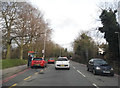
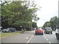
Croydon Road, Wallington
I noticed the two cars parked in the bus stop on double red lines (not a good idea), and when I passed them saw the one on the back had driven into the one in the front and wrecked itself completely, with medium damage to the victim's. Beddington Park is on the left.
Image: © David Howard
Taken: 23 Feb 2014
0.17 miles
5
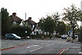
Demesne Road, Beddington, Surrey
The photographer stands in Church Road, looking northwards across the A232 (Croydon Road).
Image: © Dr Neil Clifton
Taken: 18 Oct 2007
0.18 miles
6
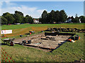
Archaeology in Beddington Park
One of the team from CADHAS (Carshalton & District History & Archaeology Society, http://www.cadhas.org.uk/ ) explained that they were excavating the remains of a house that had once stood on this site, and had exposed the cellar steps.
Image: © Stephen Craven
Taken: 19 Aug 2012
0.20 miles
8
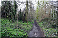
Beddington: Queen Elizabeth Walk (path)
See Image The path, although somewhat muddy, is still a pleasant walk. This is looking south, towards the exit onto Queenswood Avenue.
Image: © Dr Neil Clifton
Taken: 5 Apr 2010
0.23 miles
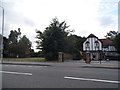
10
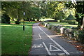
Cycle track to Carshalton, in Beddington Park
The London Borough of Sutton, which is responsible for this area, has for many years been a keen promoter of sustainable transport. A network of cycle tracks has been established, and this one through Beddington Park must be one of the most attractive.
Image: © Dr Neil Clifton
Taken: 18 Oct 2007
0.24 miles