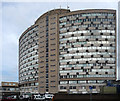
IMAGES TAKEN NEAR TO
Crown Lane, MORDEN, SM4 5BY

Introduction

This page details the photographs taken nearby to Crown Lane, SM4 5BY by members of the Geograph project.

The Geograph project started in 2005 with the aim of publishing, organising and preserving representative images for every square kilometre of Great Britain, Ireland and the Isle of Man.

There are currently over 7.5m images from over14,400 individuals and you can help contribute to the project by visiting https://www.geograph.org.uk

Image Map


Images are licensed for reuse under creativecommons.org/licenses/by-sa/2.0
Notes
  • Clicking on the map will re-center to the selected point.
  • The higher the marker number, the further away the image location is from the centre of the postcode.

Image Listing (88 Images Found)

Images are licensed for reuse under creativecommons.org/licenses/by-sa/2.0
  • ...
Image
Details
Distance
1
Morden, Salvation Army
On Crown Lane: http://www.salvationarmy.org.uk/lse/Mitcham
Image: © Mike Faherty Taken: 13 Nov 2013
0.02 miles
2
Poplar Road South, Morden
A view of Poplar Road South at its junction with Crown Lane in Morden.
Image: © Malc McDonald Taken: 17 Feb 2019
0.04 miles
3
Morden Baptist Church
On Crown Lane: http://faithinmorden.com/
Image: © Mike Faherty Taken: 13 Nov 2013
0.05 miles
4
Crown House, Morden
Dominating many views of Morden, in this case dwarfing a little Salvation Army building between houses on Crown Lane. "The main tower building was designed in 1959 by A. Green ARIBA and built between 1960 and 1962 ... the building was named Crown House after the public house that originally occupied a corner of the site" http://www.merton.gov.uk/leisure/history-heritage/architecture/civiccentrebuilding.htm .
Image: © Derek Harper Taken: 16 Nov 2010
0.07 miles
5
Crown House, Crown Lane
One of a number of individual buildings scattered around south London which stand prominently like lone tall flowers missed by the scythe. This distinctive curved slab dates from 1959-61 and was the work of A. Green. Since the 1980s it has served as Merton Council's main offices.
Image: © Stephen Richards Taken: 13 Aug 2011
0.09 miles
6
Morden shops
Row of shops at Morden. Red lines mean no stopping (double yellow lines actually mean no waiting - you can stop briefly to drop people off).
Image: © Hugh Venables Taken: 18 Oct 2008
0.09 miles
7
Links Avenue
Typical south London surburbun housing.
Image: © Hugh Venables Taken: 18 Oct 2008
0.09 miles
8
Merton Civic Centre, Morden
A view of Merton Civic Centre. The building dates from the early 1960s. It was originally built as offices and a supermarket, and was acquired by the London Borough of Merton in the 1980s. The London Borough of Merton's website has more information about the Civic Centre: https://www2.merton.gov.uk/leisure/history-heritage/architecture/civiccentrebuilding.htm
Image: © Malc McDonald Taken: 17 Feb 2019
0.10 miles
9
Morden Civic Centre
The London Borough of Merton's civic offices at Morden.
Image: © Malc McDonald Taken: 4 Jul 2010
0.10 miles
10
Morden Civic Centre
Image: © N Chadwick Taken: 17 Mar 2023
0.11 miles
  • ...