Crown House, Morden
Introduction
The photograph on this page of Crown House, Morden by Derek Harper as part of the Geograph project.
The Geograph project started in 2005 with the aim of publishing, organising and preserving representative images for every square kilometre of Great Britain, Ireland and the Isle of Man.

There are currently over 7.5m images from over 14,400 individuals and you can help contribute to the project by visiting https://www.geograph.org.uk
Crown House, Morden
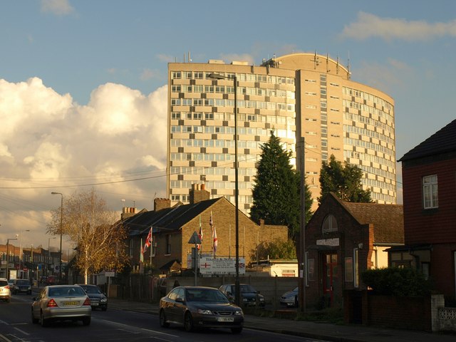
Image: © Derek Harper Taken: 16 Nov 2010
Dominating many views of Morden, in this case dwarfing a little Salvation Army building between houses on Crown Lane. "The main tower building was designed in 1959 by A. Green ARIBA and built between 1960 and 1962 ... the building was named Crown House after the public house that originally occupied a corner of the site" http://www.merton.gov.uk/leisure/history-heritage/architecture/civiccentrebuilding.htm .
Images are licensed for reuse under creativecommons.org/licenses/by-sa/2.0
Image Location
Latitude
51.400757
Longitude
-0.197266