IMAGES TAKEN NEAR TO
Wayside Gardens, GERRARDS CROSS, SL9 7NG
Introduction
This page details the photographs taken nearby to Wayside Gardens, SL9 7NG by members of the Geograph project.
The Geograph project started in 2005 with the aim of publishing, organising and preserving representative images for every square kilometre of Great Britain, Ireland and the Isle of Man.

There are currently over 7.5m images from over14,400 individuals and you can help contribute to the project by visiting https://www.geograph.org.uk
Image Map
Images are licensed for reuse under creativecommons.org/licenses/by-sa/2.0
Notes
- Clicking on the map will re-center to the selected point.
- The higher the marker number, the further away the image location is from the centre of the postcode.
Image Listing (13 Images Found)
Images are licensed for reuse under creativecommons.org/licenses/by-sa/2.0
Image
Details
Distance
2
House in Camp Road, Gerrards Cross
Camp Road is a private road around Bulstrode Fort
Image: © David Hawgood
Taken: 22 Jun 2005
0.15 miles
3
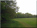
The southern edge of Bulstrode Camp
Bulstrode Camp is a good example of a large multivallate hillfort. It is the largest hill fort in Buckinghamshire, covering an area of 10.67 hectares (26.38 acres).
Image: © Rod Allday
Taken: 18 May 2013
0.15 miles
4
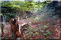
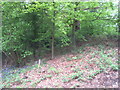
Bank and Ditch, Bulstrode Camp
Bulstrode Camp is the largest Iron Age fort in Buckinghamshire. Originally in quite a dominating position, it is now surrounded by suburban housing and is more of a local park than a notable antiquity.
The circular fortifications are covered with trees and undergrowth as seen here. The interior is a grassy meadow. The name Bulstrode, first recorded as ‘Burstrod’, derives from the Anglo-Saxon for “the marsh belonging to the fort”
More information on http://gerrardscross.gov.uk/bulstrode-camp/
Image: © Des Blenkinsopp
Taken: 30 Oct 2019
0.17 miles
5
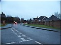
Hedgerley Lane, Gerrards Cross
The road has a little appendix here attached to the main part.
Image: © David Howard
Taken: 27 Jan 2018
0.20 miles
6
Ditch and rampart on the eastern edge of Bulstrode Camp
See Image for details of this hill fort.
Image: © Rod Allday
Taken: 18 May 2013
0.20 miles
9
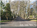
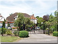
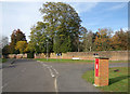
Gerrards Cross: Camp Road
The progress of the residential development of the area to the south-west of the A40 in Gerrards Cross is well illustrated in large scale Ordnance Survey maps. When the 1925 edition was published there were no houses here at all. By 1938 much of the present-day development along the A40 and along Windsor Road was complete, and the construction of the private estate around The Camp had begun with some fifteen or so houses built. This construction work continued after the Second World War, and this is the present-day entrance to the estate, from the B416 Windsor Road, along the private Camp Road.
Image: © Nigel Cox
Taken: 22 Dec 2013
0.23 miles
10
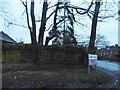
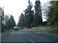
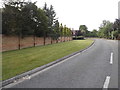
Camp Road at the junction of Windsor Road
Image: © David Howard
Taken: 27 Jan 2018
0.23 miles