IMAGES TAKEN NEAR TO
Old Slade Lane, IVER, SL0 9DR
Introduction
This page details the photographs taken nearby to Old Slade Lane, SL0 9DR by members of the Geograph project.
The Geograph project started in 2005 with the aim of publishing, organising and preserving representative images for every square kilometre of Great Britain, Ireland and the Isle of Man.

There are currently over 7.5m images from over14,400 individuals and you can help contribute to the project by visiting https://www.geograph.org.uk
Image Map
Images are licensed for reuse under creativecommons.org/licenses/by-sa/2.0
Notes
- Clicking on the map will re-center to the selected point.
- The higher the marker number, the further away the image location is from the centre of the postcode.
Image Listing (17 Images Found)
Images are licensed for reuse under creativecommons.org/licenses/by-sa/2.0
Image
Details
Distance
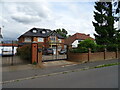
3
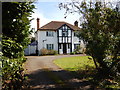
Iver - Old Slade Lane
One of the few original houses left in the street, most of the houses have been completely redeveloped.
Image: © James Emmans
Taken: 25 Mar 2017
0.09 miles
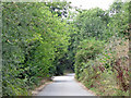
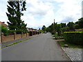
4
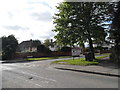
Richings Way at the junction of Wellesley Avenue
Image: © David Howard
Taken: 11 May 2014
0.15 miles
5
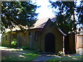
St Leonard's Church, Iver
Early afternoon in winter sunshine, looking north. The parish website http://www.iverparish.co.uk/ of St Peter's and St Leonard's, Iver, tells us:
"St Leonard's is the small "daughter" church in Richings Park. It started life in 1840 as a little square community room for the estate workers of the Richings Park mansion. In order to become a proper place of worship for the community, it had a small chancel area added to it in 1874 and it was named Thorney Chapel. When the Richings Park estate of houses and the new Iver station were built in the 1920's, many more people came to the area. Thorney Chapel was doubled in length to its present size in 1931 and was renamed St Leonard's Church in 1942."
Image: © David Hawgood
Taken: 21 Jan 2006
0.16 miles
6
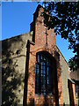
The western elevation of the church at Richings Park
Image: © Shazz
Taken: 4 Sep 2013
0.16 miles
7
The northern elevation of the church at Richings Park
Image: © Shazz
Taken: 4 Sep 2013
0.17 miles
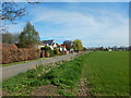
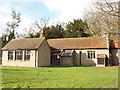
8
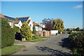
Houses Down One Side
Showing the mixed Town & Country character of this area just beyond the edge of fully built up London.
Suburban housing on one side of the road and farmland on the other.
Image: © Des Blenkinsopp
Taken: 6 Nov 2017
0.17 miles