
IMAGES TAKEN NEAR TO
High Street, ROYSTON, SG8 8HZ
Introduction
This page details the photographs taken nearby to High Street, SG8 8HZ by members of the Geograph project.
The Geograph project started in 2005 with the aim of publishing, organising and preserving representative images for every square kilometre of Great Britain, Ireland and the Isle of Man.

There are currently over 7.5m images from over14,400 individuals and you can help contribute to the project by visiting https://www.geograph.org.uk
Image Map
Images are licensed for reuse under creativecommons.org/licenses/by-sa/2.0
Notes
- Clicking on the map will re-center to the selected point.
- The higher the marker number, the further away the image location is from the centre of the postcode.
Image Listing (60 Images Found)
Images are licensed for reuse under creativecommons.org/licenses/by-sa/2.0
Image
Details
Distance
1
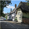
Barley: historic houses on the High Street
Some of many Grade II listed timber-framed houses on the west side of High Street.
Image: © John Sutton
Taken: 1 Aug 2018
0.00 miles
2
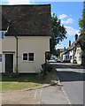
Barley: historic houses
High Street is rich in Grade II listed timber-framed houses. The nearest, Lower Farm House, dates from c 1500, but has been much altered in the succeeding centuries.
Image: © John Sutton
Taken: 1 Aug 2018
0.03 miles
3
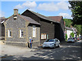
Barley: flint, weatherboard, plaster and thatch
A good collection of local vernacular building materials on High Street.
Image: © John Sutton
Taken: 1 Aug 2018
0.03 miles
4
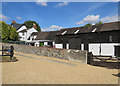
Barley: Hanaper Drive
A house and restored barns off High Street.
Image: © John Sutton
Taken: 1 Aug 2018
0.04 miles
5
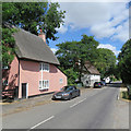
Barley: pink and white
Some of many timber-framed houses on the west side of High Street. The further one is Grade II listed and dates from the 17th century, with later alterations.
Image: © John Sutton
Taken: 1 Aug 2018
0.05 miles
6
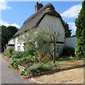
Barley: Icknield Way Cottage, High Street
The Grade II listed timber-framed house dates from the early part of the 18th century, the shop extension (no longer a shop) to the left from the 19th.
Image: © John Sutton
Taken: 1 Aug 2018
0.05 miles
7
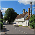
Barley: White Posts
One of many listed buildings on the west side of High Street. The Grade II listing text begins "Mid to late C16 with C18 additions. Restored 1976. Timber frame, roughcast. Steeply-pitched tiled roof. Four bays, two storeys with one-bay one-storey additions at both ends. Continuous jetty to front on original block".
Image: © John Sutton
Taken: 1 Aug 2018
0.05 miles
8
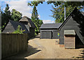
Barley: weatherboarded barns
Barn conversions off the High Street.
Image: © John Sutton
Taken: 1 Aug 2018
0.05 miles
9
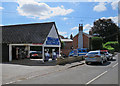
Barley: Drayton's Garage
Garages and petrol stations were once common in villages but are now rare.
Image: © John Sutton
Taken: 1 Aug 2018
0.10 miles
10
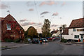
B1368, Barley, Essex
The Fox and Hounds Public House can be seen on the right.
Image: © Christine Matthews
Taken: 19 Oct 2014
0.11 miles