
IMAGES TAKEN NEAR TO
Byde Street, HERTFORD, SG14 3AL
Introduction
This page details the photographs taken nearby to Byde Street, SG14 3AL by members of the Geograph project.
The Geograph project started in 2005 with the aim of publishing, organising and preserving representative images for every square kilometre of Great Britain, Ireland and the Isle of Man.

There are currently over 7.5m images from over14,400 individuals and you can help contribute to the project by visiting https://www.geograph.org.uk
Image Map
Images are licensed for reuse under creativecommons.org/licenses/by-sa/2.0
Notes
- Clicking on the map will re-center to the selected point.
- The higher the marker number, the further away the image location is from the centre of the postcode.
Image Listing (39 Images Found)
Images are licensed for reuse under creativecommons.org/licenses/by-sa/2.0
Image
Details
Distance
1
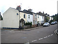
Bengeo: Byde Street
The name of the village of Bengeo is derived from an Anglo-Saxon word describing a spur or ridge over the River Beane.
Byde Street is named after Sir Thomas Byde, The Recorder of London in 1669, who rebuilt the mansion at nearby Ware Park, and is the only road with that name in Great Britain.
Image: © Nigel Cox
Taken: 28 Jun 2007
0.02 miles
2
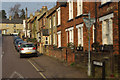
Nelson Street, Lower Bengeo
Attractive houses in a variety of different brick colours line this street climbing out of the River Beane valley.
Image: © Stephen McKay
Taken: 28 Mar 2011
0.05 miles
3
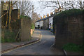
Port Vale, Lower Bengeo
The remains of the bridge here once carried a railway branch line from Welwyn Garden City to Hertford East. The last train passed this way in 1966 although it has been suggested as a possible route for the east - west (Cambridge - Oxford) link.
Image: © Stephen McKay
Taken: 28 Mar 2011
0.05 miles
4
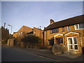
Houses on Byde Street, Bengeo
The ultra modern has been placed among traditional Victorian workmen's cottages and the much more recent copies built next door in this view. Most in the road are still the original types.
Image: © David Howard
Taken: 16 Feb 2016
0.05 miles
5
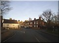
Beane Road at the junction of Port Vale
Just over the River Beane in Bengeo
Image: © David Howard
Taken: 16 Feb 2016
0.07 miles
6
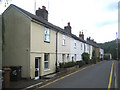
Bengeo: Port Vale
Port Vale is the intriguing name of an area and this street in Lower Bengeo, north of the River Beane and Hertford.
Image: © Nigel Cox
Taken: 28 Jun 2007
0.09 miles
7
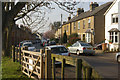
Molewood Road, Lower Bengeo
Molewood road seen from its junction with Beane road.
Image: © Stephen McKay
Taken: 28 Mar 2011
0.09 miles
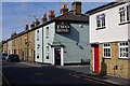

10
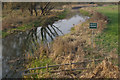
River Beane, Lower Bengeo
Private fishing only in this tributary of the River Lea. The River Beane rises in the area between Buntingford and Baldock before flowing south through Watton at Stone to Hertford.
Image: © Stephen McKay
Taken: 28 Mar 2011
0.18 miles