1
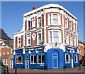
Former vicarage, Barkworth Road, South Bermondsey
The vicarage was associated with the adjacent St Bartholomew's church, which has now been replaced with housing
Image
Image: © Stephen Craven
Taken: 14 Apr 2015
0.02 miles
2
Plaque on former vicarage, Barkworth Road, South Bermondsey
Image: © Stephen Craven
Taken: 14 Apr 2015
0.02 miles
3
Site of St Bartholomew's church
This is a block of social housing on the south side of Barkworth Road, South Bermondsey. It was built by the Southwark and London Diocesan Housing Association on the site of St Bartholomew's church which occupied the site from 1887 to 1994. http://www.southwark.anglican.org/downloads/lostchurches/CAM06.pdf The church heritage is reflected in the small pinnacled tower on the corner of the new block.
Image: © Stephen Craven
Taken: 18 Jul 2009
0.04 miles
4
Bramcote Grove Playground, Rotherhithe, London SE16
At the junction with Barkworth and Verney Roads - when the area was revamped it was planned to build dwellings on the playground until it was discovered that the ground was donated by a wealthy benefactor for locals to use "in perpetuity" as a park (in 1914 dwellings were on the site). Believe the benefactor was from Chislehurst in Kent as people from that area donated large amounts of cash for this particular part of Rotherhithe in the late 1800s.
Image: © Chris Lordan
Taken: 23 Sep 2009
0.04 miles
5
Bramcote pub. 68, Bramcote Grove, Rotherhithe, London, SE16
At the junction with Barkworth Road and as it has 1886 on side, can only assume that was when it was built. Known for many years as The Bramcote Arms but now known just as the Bramcote, although the owners seem to be backing it both ways.
Image: © Chris Lordan
Taken: 12 Oct 2009
0.04 miles
6
Bramcote Park, South Bermondsey
The entrance off Varcoe Road. The "park" is in fact just a pair of small areas each about 50x50m either side of Verney Road.
Image: © Stephen Craven
Taken: 10 Jul 2015
0.05 miles
7
Traffic barrier, Varcoe Road, South Bermondsey
Barriers like this are needed on most of the residential streets in this area as otherwise they become rat runs for drivers trying to escape the congestion on the Old Kent Road. Space is left at one end for cyclist permeability.
Image: © Stephen Craven
Taken: 10 Jul 2015
0.05 miles
8
The Bramcote Arms
On the corner of Bramcote Grove and Barkworth Road, a typical 19th century London "local" pub, serving the streets around it. Unlike many others, and unlike the local church
Image, this one survived redevelopment of the area and is still open.
Image: © Stephen Craven
Taken: 18 Jul 2009
0.05 miles
9
Batwa House, Varcoe Road, South Bermondsey
A modern apartment block.
Image: © Stephen Craven
Taken: 10 Jul 2015
0.05 miles
10
Crown Place, Varcoe Road, South Bermondsey
A modern apartment block.
Image: © Stephen Craven
Taken: 10 Jul 2015
0.06 miles


