Site of St Bartholomew's church
Introduction
The photograph on this page of Site of St Bartholomew's church by Stephen Craven as part of the Geograph project.
The Geograph project started in 2005 with the aim of publishing, organising and preserving representative images for every square kilometre of Great Britain, Ireland and the Isle of Man.

There are currently over 7.5m images from over 14,400 individuals and you can help contribute to the project by visiting https://www.geograph.org.uk
Site of St Bartholomew's church
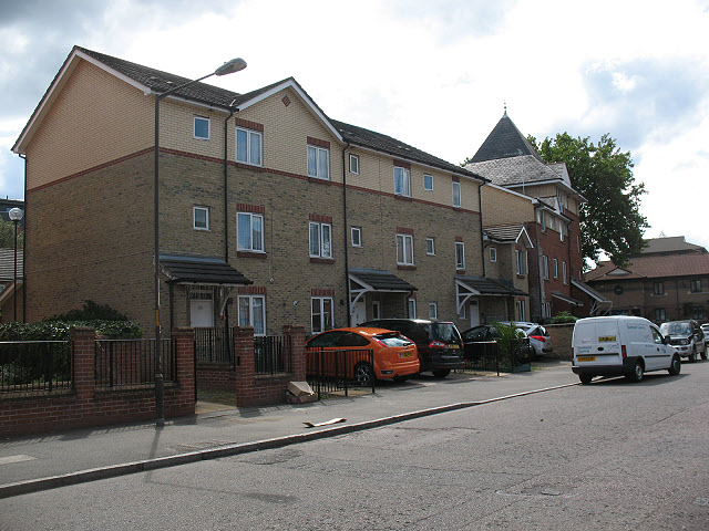
Image: © Stephen Craven Taken: 18 Jul 2009
This is a block of social housing on the south side of Barkworth Road, South Bermondsey. It was built by the Southwark and London Diocesan Housing Association on the site of St Bartholomew's church which occupied the site from 1887 to 1994. http://www.southwark.anglican.org/downloads/lostchurches/CAM06.pdf The church heritage is reflected in the small pinnacled tower on the corner of the new block.
Images are licensed for reuse under creativecommons.org/licenses/by-sa/2.0
Image Location
Latitude
51.486207
Longitude
-0.057785