
IMAGES TAKEN NEAR TO
Bank End Lane, BARNSLEY, S75 4BB
Introduction
This page details the photographs taken nearby to Bank End Lane, S75 4BB by members of the Geograph project.
The Geograph project started in 2005 with the aim of publishing, organising and preserving representative images for every square kilometre of Great Britain, Ireland and the Isle of Man.

There are currently over 7.5m images from over14,400 individuals and you can help contribute to the project by visiting https://www.geograph.org.uk
Image Map
Images are licensed for reuse under creativecommons.org/licenses/by-sa/2.0
Notes
- Clicking on the map will re-center to the selected point.
- The higher the marker number, the further away the image location is from the centre of the postcode.
Image Listing (27 Images Found)
Images are licensed for reuse under creativecommons.org/licenses/by-sa/2.0
Image
Details
Distance
1
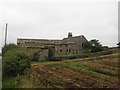
Winter Hill Farm
Seen across a well-slurried field!
Image: © John Slater
Taken: 30 Sep 2013
0.01 miles
2
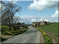
Bank End Lane looking to Winter Hill Farm
Image: © John Fielding
Taken: 10 Apr 2008
0.01 miles
3
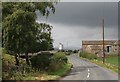
High Hoyland looking towards the Pennines
Image: © Walking person
Taken: 7 Aug 2008
0.02 miles
4
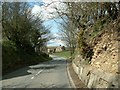
Bank End Lane
Winter Hill Farm can be seen centre of pic.
Image: © John Fielding
Taken: 10 Apr 2008
0.03 miles
5
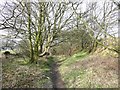
Bridleway, High Hoyland
This could be called the 'High Hoyland Bypass' as it loops round the village on the edge of Hoyland Bank Wood. I could just see a quarry face on the right – for future investigation!
Image: © Humphrey Bolton
Taken: 14 Mar 2008
0.06 miles
7
View from High Hoyland over to Pennines
Image: © Walking person
Taken: 11 Jul 2006
0.07 miles
8
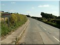
Welcome to Barnsley on Bank End Lane
You are about to leave West Yorkshire and enter the village of High Hoyland in Barnsley South Yorkshire.
Image: © John Fielding
Taken: 4 Sep 2007
0.11 miles
9
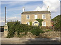
The Old School House, High Hoyland
Captioned 'National School' on the 1850 map. I think the school was in a wing behind the school house. It seems odd that it is sited at the very edge of High Hoyland township, but was probably also intended to serve Clayton West, which was in the bparish of High Hoyland at that time.
Image: © Humphrey Bolton
Taken: 7 Sep 2003
0.12 miles
10
Road junction and footpath sign near High Hoyland
Image: © Steve Fareham
Taken: 4 Dec 2014
0.12 miles