
IMAGES TAKEN NEAR TO
Portland Crescent, CHESTERFIELD, S44 6EG
Introduction
This page details the photographs taken nearby to Portland Crescent, S44 6EG by members of the Geograph project.
The Geograph project started in 2005 with the aim of publishing, organising and preserving representative images for every square kilometre of Great Britain, Ireland and the Isle of Man.

There are currently over 7.5m images from over14,400 individuals and you can help contribute to the project by visiting https://www.geograph.org.uk
Image Map
Images are licensed for reuse under creativecommons.org/licenses/by-sa/2.0
Notes
- Clicking on the map will re-center to the selected point.
- The higher the marker number, the further away the image location is from the centre of the postcode.
Image Listing (78 Images Found)
Images are licensed for reuse under creativecommons.org/licenses/by-sa/2.0
Image
Details
Distance
1
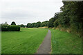
Hornscroft Park
The bank to the right of the path is all that now remains of the mediaeval town boundary.
Image: © Bill Boaden
Taken: 25 Jul 2021
0.05 miles
2
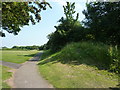
Earthworks, Bolsover
Bolsover Castle is well protected to the west by a sheer drop. The land to the south and east is flatter, and defensive earthworks were built.
Image: © Peter Barr
Taken: 26 Jun 2010
0.06 miles
3
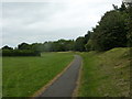
Footpath by the old town walls
The wall and ditch, dating from the 13th century, run to the right of the footpath, providing protection from the open plateau to the east. The embankment now marks the edge of a park and recreation area by Hornscroft Road.
Image: © Andrew Hill
Taken: 16 May 2011
0.06 miles
4
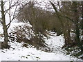
Bolsover Defensive Earthworks
Part of the surviving medieval 'ditch and bank' earthworks at the edge of an area known as the Hornscroft in Bolsover, believed to date from about the 13th century.
Image: © Gordon Elliott
Taken: 12 Feb 2009
0.07 miles
5
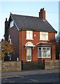
Red brick house on Langwith Road, Bolsover
Image: © Neil Theasby
Taken: 11 Nov 2012
0.11 miles
6

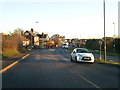
Top of New Station Road
The road heads down the hill to Carr Vale and modern housing estates on the hillside. Neither the new station (at Carr Vale) nor the other station serving the town is in existence any longer.
Image: © Andrew Hill
Taken: 17 May 2011
0.11 miles
8
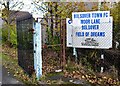
Field of Dreams
Entrance to Bolsover Town's football ground - shared with other amateur teams from the town.
Image: © Neil Theasby
Taken: 11 Nov 2012
0.13 miles
10
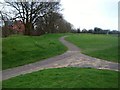
Defensive Earthwork in Bolsover
13th Century bank and ditch situated in Hornscroft Park. The bank would probably have been further fortified with wooden fencing in order to defend the eastern side of the medieval town.
Image: © Jonathan Clitheroe
Taken: 17 Mar 2012
0.15 miles