IMAGES TAKEN NEAR TO
Lance Street, RAINHAM, RM13 8LP
Introduction
This page details the photographs taken nearby to Lance Street, RM13 8LP by members of the Geograph project.
The Geograph project started in 2005 with the aim of publishing, organising and preserving representative images for every square kilometre of Great Britain, Ireland and the Isle of Man.

There are currently over 7.5m images from over14,400 individuals and you can help contribute to the project by visiting https://www.geograph.org.uk
Image Map
Images are licensed for reuse under creativecommons.org/licenses/by-sa/2.0
Notes
- Clicking on the map will re-center to the selected point.
- The higher the marker number, the further away the image location is from the centre of the postcode.
Image Listing (133 Images Found)
Images are licensed for reuse under creativecommons.org/licenses/by-sa/2.0
Image
Details
Distance

3
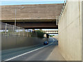
Railway bridges over Lamson Road
The nearest is the Channel Tunnel high speed line, the other the original LTSR line, London to Southend via Tilbury.
Image: © Robin Webster
Taken: 24 Apr 2011
0.09 miles
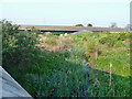
4
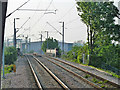
Railway over Rainham Creek
The hump in the track ahead is for the bridge over Rainham Creek, which when the LTSR was constructed was still navigated to Rainham Wharf (necessarily near high tide), so clearance for barges was required.
Image: © Robin Webster
Taken: 24 Apr 2011
0.10 miles
6
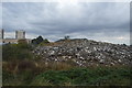
Rainham Wharf
Used commercially up to 1929, it is now partly a tiny public open space (to the right). It will never be used again, as the mouth of Rainham Creek has been dammed.
Image: © Robin Webster
Taken: 24 Apr 2011
0.12 miles
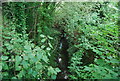
9
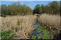
Rainham Creek above the Lamson Road bridge
No longer a navigable tidal creek up to Rainham, it now has its natural mouth to the Thames built over and its outfall controlled by sluices. Most of the flow under usual conditions enters below this point from a sewage works.
Image: © Robin Webster
Taken: 24 Apr 2011
0.14 miles
10
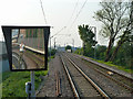
Nearly a driver's eye view, Rainham
Looking towards London from the end of the platform, with the mirror for one man operation on the left. The hump in the track ahead is for the bridge over Rainham Creek, which when the railway was constructed was still navigated to Rainham Wharf (necessarily near high tide), so clearance for barges was required. Who's that person in the mirror?
Image: © Robin Webster
Taken: 24 Apr 2011
0.14 miles