
IMAGES TAKEN NEAR TO
Washington Road, PULBOROUGH, RH20 4BZ
Introduction
This page details the photographs taken nearby to Washington Road, RH20 4BZ by members of the Geograph project.
The Geograph project started in 2005 with the aim of publishing, organising and preserving representative images for every square kilometre of Great Britain, Ireland and the Isle of Man.

There are currently over 7.5m images from over14,400 individuals and you can help contribute to the project by visiting https://www.geograph.org.uk
Image Map
Images are licensed for reuse under creativecommons.org/licenses/by-sa/2.0
Notes
- Clicking on the map will re-center to the selected point.
- The higher the marker number, the further away the image location is from the centre of the postcode.
Image Listing (22 Images Found)
Images are licensed for reuse under creativecommons.org/licenses/by-sa/2.0
Image
Details
Distance
2
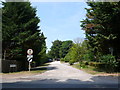
Woodpecker Lane
Woodpecker lane is a private, and very poorly maintained road that consists mainly of very large detached houses. A 3-bed bungalow costs about £500,000 here. the road loops round to meet Nightingale Lane
Image: © Nigel Mykura
Taken: 22 Jul 2013
0.06 miles

4
Post Box
RH20 247 Sussex Down RAF Home (Storrington)
Image: © The Saunterer
Taken: 14 Nov 2012
0.08 miles
5

Footpath FP2631
Along Heather Way north of A283
Image: © The Saunterer
Taken: 14 Nov 2012
0.11 miles
6
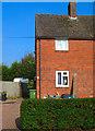
How Much is that Doggie in the Window?
No woof woof though, just seemed content to stand there and stare out at the world outside. The house concerned is in Meadowside.
Image: © Simon Carey
Taken: 11 Oct 2008
0.14 miles
7

Sand pit at Storrington seen from Chantry Hill
The red gash across the landscape is easy to see even on a dull afternoon.
Image: © Shazz
Taken: 19 Jul 2011
0.14 miles
8
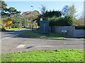
Air Quality Monitoring Station
The monitoring station is within a self-contained, air-conditioned housing located on the junction of A283 Manley's Hill and Meadowside. The manifold inlet is approximately 3 metres above ground level and approximately 7 metres distance from the A283. The A283 has an average daily traffic flow of approximately 18,000 vehicles per day. The surrounding area is open suburban.
Image: © The Saunterer
Taken: 14 Nov 2012
0.15 miles
9
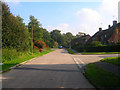
Meadowside
Post war housing estate in Storrington. The road heads south east crosses the River Stor then turns westwards before becoming Browns Lane. The junction is with Ravenscroft a 1960s housing estate.
Image: © Simon Carey
Taken: 11 Oct 2008
0.15 miles
10
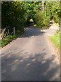
Chantry Lane
Possibly an old droving road as it begins on Chantry Hill then heads northwards to the A283 then continues as other lanes towards what was once Chiltington Common. Here it is crossing the River Stor.
Image: © Simon Carey
Taken: 11 Oct 2008
0.16 miles