
IMAGES TAKEN NEAR TO
Brodford Way, HAYWARDS HEATH, RH16 4UH
Introduction
This page details the photographs taken nearby to Brodford Way, RH16 4UH by members of the Geograph project.
The Geograph project started in 2005 with the aim of publishing, organising and preserving representative images for every square kilometre of Great Britain, Ireland and the Isle of Man.

There are currently over 7.5m images from over14,400 individuals and you can help contribute to the project by visiting https://www.geograph.org.uk
Image Map
Images are licensed for reuse under creativecommons.org/licenses/by-sa/2.0
Notes
- Clicking on the map will re-center to the selected point.
- The higher the marker number, the further away the image location is from the centre of the postcode.
Image Listing (59 Images Found)
Images are licensed for reuse under creativecommons.org/licenses/by-sa/2.0
Image
Details
Distance
1
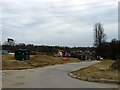
Saddlers Way, Bolnore Village
The new road will be the access route for the last phase of the Bolnore village development. This section occupies a former field called Crabtree Field, according to Cuckfield's 1843 tithe map.
Image: © Simon Carey
Taken: 30 Mar 2015
0.04 miles
2
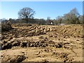
Mope Field
The name of the field according to Cuckfield's 1843 tithe map that was later merged with Image to the south and is now about to disappear under the last phase of the Bolnore village development.
Image: © Simon Carey
Taken: 7 Mar 2015
0.10 miles
3
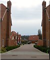
Shire Lane, Haywards Heath
Once part of a field called Upper meadow according to Cuckfield's 1843 tithe map, this small cul de sac off Bolnore Road was built in the last couple of years. The South Downs can be seen in the distance.
Image: © Simon Carey
Taken: 30 Mar 2015
0.11 miles
4
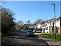
Climping Close, Haywards Heath
A cul de sac off Wealden Way that was built in the 1970s on a former field called Lower Meadow, according to Cuckfield's 1843 tithe map, that had once belonged to Great Haywards Farm. To the south is Image which is in the process of being built on as part of the bolnore village development.
Image: © Simon Carey
Taken: 7 Mar 2015
0.11 miles
5
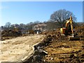
Four Acres (1)
The name of the field according to Cuckfield's 1843 tithe map that was merged with Image to the north and is now about to disappear under the last phase of the Bolnore village development. Some of the former hedgerow trees will remain as part of the new estate.
Image: © Simon Carey
Taken: 7 Mar 2015
0.12 miles
6
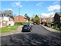
Duncton Close, Haywards Heath
A small cul de sac off Climping Close built in the late 1970s on former fields belonging to Great Haywards Farm.
Image: © Simon Carey
Taken: 31 Mar 2015
0.12 miles
7
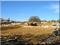
Four Acres (2)
The name of the field according to Cuckfield's 1843 tithe map that was merged with Image to the north and will soon disappear under the last phase of the Bolnore village development. Some hedgerow oaks have been retained as part of the development.
Image: © Simon Carey
Taken: 7 Mar 2015
0.12 miles
8
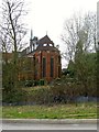
Chapel Heights, Bolnore Road, Haywards Heath
The former chapel was converted into flats in 2001 and having once been the place of worship for the community of the Holy Cross convent which moved to Haywards Heath in 1886 and left in 1979. The former nunnery known as Grosvenor Hall was converted into offices in 1980 and has been occupied by the charity Sightsavers since 1990 though they too are due to move and have sold the building so it can be converted into housing.
The former convert occupied the northern end of Reading Wood part of which still survives to the south and contains a burial area for the former nuns.
Image: © Simon Carey
Taken: 30 Mar 2015
0.14 miles
9
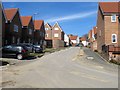
Chandlers Field Drive, Bolnore Village
Recently completed part of the Bolnore development which has yet to appear on any OS map so the map references are a rough guess. According to Cuckfield's 1843 tithe map this road occupies a former field called Lower Eight Acres.
Image: © Simon Carey
Taken: 7 Mar 2015
0.15 miles
10
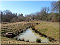
Pond Meadow
The name of the field given by the Friends of Ashenground and Bolnore Woods and part of the Ashenground Park nature reserve which has been formed from the remnants of the woods that have been felled to make way for the bolnore village development. On Cuckfield's 1843 tithe map it is called The Lag and its boggy nature has probably assisted in its survival where it is now used as drainage.
Image: © Simon Carey
Taken: 7 Mar 2015
0.15 miles