
IMAGES TAKEN NEAR TO
Beech Hill, HAYWARDS HEATH, RH16 3SE
Introduction
This page details the photographs taken nearby to Beech Hill, RH16 3SE by members of the Geograph project.
The Geograph project started in 2005 with the aim of publishing, organising and preserving representative images for every square kilometre of Great Britain, Ireland and the Isle of Man.

There are currently over 7.5m images from over14,400 individuals and you can help contribute to the project by visiting https://www.geograph.org.uk
Image Map
Images are licensed for reuse under creativecommons.org/licenses/by-sa/2.0
Notes
- Clicking on the map will re-center to the selected point.
- The higher the marker number, the further away the image location is from the centre of the postcode.
Image Listing (22 Images Found)
Images are licensed for reuse under creativecommons.org/licenses/by-sa/2.0
Image
Details
Distance
1
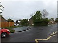
Aspen Close, Franklands Village
One of the roads named after species of trees in this modern estate
Image: © David Smith
Taken: 1 May 2014
0.03 miles
2
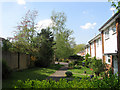
Houses, Beech Hill, Franklands Village
Viewed from the footpath that links Lyoth Lane to Lewes Road the houses were built in the 1980s on the site of Northlands Wood which was once the northern extremity of Wivelsfield parish but was transferred to Haywards Heath in 1934 and developed over the following decades.
Image: © Simon Carey
Taken: 20 Apr 2011
0.07 miles
3
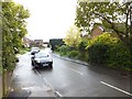
Maple Close, Franklands Village
One of the roads named after species of trees in this modern estate
Image: © David Smith
Taken: 1 May 2014
0.08 miles
4
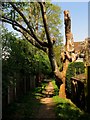
Footpath, Lyoth Common
Linking Lyoth Lane to Lewes Road. The path was straightened during an 18th century enclosure and marked the boundary between the former common on the right and the site of Northlands Wood to the left. Both have now disappeared under housing estates. The area was once part of Wivelsfield parish but was transferred to Haywards Heath in 1934.
Image: © Simon Carey
Taken: 20 Apr 2011
0.10 miles
5
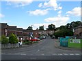
Larch Way, Haywards Heath
A cul de sac off Northlands Avenue built in the 1970s as part of the Northlands estate on the site of Northlands Wood that had originally been part of the parish of Wivelsfield but was transferred to Haywards Heath in 1934. On the right is the estate's convenience store, originally run by One Stop, which closed in February 2015 for a long refurbishment before reopening in 2016 as a Tesco Express.
Image: © Simon Carey
Taken: 6 Sep 2015
0.10 miles
6
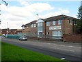
Northlands Wood Practice, Walnut Park, Haywards Heath
Viewed from Northlands Avenue and built in the 1970s as part of the Northlands estate on the site of Northlands Wood that had originally been part of the parish of Wivelsfield but was transferred to Haywards Heath in 1934. To its left is the estate's convenience store, originally run by One Stop which closed in February 2015, and is currently undergoing a long refurbishment before reopening in 2016 as a Tesco Express.
Image: © Simon Carey
Taken: 6 Sep 2015
0.12 miles
7
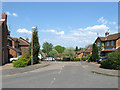
The Oaks, Lyoth Common
A modern cul-de-sac off Marlow Drive built in the 1990s on the site of Northlands Wood which once formed the northern end of Wivelsfield parish but was transferred to Haywards Heath in 1934.
Image: © Simon Carey
Taken: 20 Apr 2011
0.13 miles
8
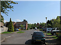
Cobbetts Mead, Lyoth Common
The name of the road in the foreground which begins at the junction of Charlesworth Park to the left with Orchid Park straight ahead. The latter are named after Charlesworth Nursery which occupied the site from the early 20th century to the 1950s and became well known for the cultivation of orchids. Prior to their arrival the area had been a common that was gradually encroached upon between the 17th and 19th centuries leaving only a narrow strip by the time of the 1843 tithe survey. Formerly a part of Wivelsfield parish this area was transferred to Haywards Heath in 1934.
Image: © Simon Carey
Taken: 20 Apr 2011
0.13 miles
9
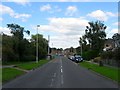
Northlands Avenue, Haywards Heath
The main access route for Franklands Village and the Northlands estate built along with the latter in the 1970s as part of the Northlands estate on the site of Northlands Wood that had originally been part of the parish of Wivelsfield but was transferred to Haywards Heath in 1934. The road begins as Frankton Avenue on the B2272 becoming Northlands Avenue at the junction with Gravelye Lane at the entrance to Franklands Village rejoining that road over the parish boundary with Lindfield. The sewer vent pipe on the right also marks the location of Northlands Brook now culverted and part of the sewer system of the estate.
Image: © Simon Carey
Taken: 6 Sep 2015
0.13 miles
10
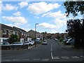
Laburnum Way, Haywards Heath
A residential road linking Northlands Avenue to Beech Hill built in the 1970s as part of the Northlands estate on the site of Northlands Wood that had originally been part of the parish of Wivelsfield but was transferred to Haywards Heath in 1934.
Image: © Simon Carey
Taken: 6 Sep 2015
0.13 miles