
IMAGES TAKEN NEAR TO
Meadow Lane, BURGESS HILL, RH15 9JD
Introduction
This page details the photographs taken nearby to Meadow Lane, RH15 9JD by members of the Geograph project.
The Geograph project started in 2005 with the aim of publishing, organising and preserving representative images for every square kilometre of Great Britain, Ireland and the Isle of Man.

There are currently over 7.5m images from over14,400 individuals and you can help contribute to the project by visiting https://www.geograph.org.uk
Image Map
Images are licensed for reuse under creativecommons.org/licenses/by-sa/2.0
Notes
- Clicking on the map will re-center to the selected point.
- The higher the marker number, the further away the image location is from the centre of the postcode.
Image Listing (10 Images Found)
Images are licensed for reuse under creativecommons.org/licenses/by-sa/2.0
Image
Details
Distance
1
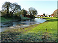
Flooded amenity land
A scrap of open space, only accessible from Potters Lane in the distance. Its propensity to flood may be the reason it has been left undeveloped. Frost persists in the shade, and the water is lightly iced over.
Image: © Robin Webster
Taken: 26 Nov 2010
0.09 miles
3
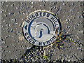
Roman road marker, Nightingale Lane
The short roughly north-south part of this road is on the alignment of Roman road 150. This marker is set in the pavement tarmac. There are others marking the line elsewhere in Burgess Hill.
Image: © Robin Webster
Taken: 26 Nov 2010
0.12 miles
4
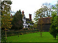
Hammonds Place, Burgess Hill
Hammonds Place was built in the 16th century. The original building was damaged by fire and it was subsequently rebuilt & added to. It was never a working farm though. Hammonds Farm was originally owned by Little Hammonds Farm House, which is situated opposite Hammonds Place tucked in just behind the barn you can see on the right. Little Hammonds Farm House (now known as Little Hammonds) dates back to the 1590's (extended in the early 1900's). The working farm was sold to developers Wates in the mid 1960's and subsequently developed in the late 1980's / early 1990's (Hammonds Ridge housing estate, Tesco, etc). In between outbuildings were used by Hammonds Place amongst others. Stabling and a large milking yard originally adjoined the house on the North Westerly corner. The barn in the picture was originally also part of the farm, it was developed into a residential dwelling in the late 1990's.
Information kindly provided by Craig Maddock.
Image: © Simon Carey
Taken: 5 Nov 2005
0.15 miles
5
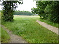
Looking across Nightingale Meadows from public footpath
This is part of the Green Crescent - see http://www.burgesshill.gov.uk/greencircle.
Image: © Shazz
Taken: 22 Jun 2016
0.20 miles
6
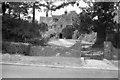
Hammonds Place
A Grade II listed building. The east front carries the date 1566.
Image: © Peter Jeffery
Taken: Unknown
0.20 miles
7
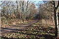
A Bridle Path
Part of the Burgess Hill Green Circular Route.
Image: © Peter Jeffery
Taken: 22 Dec 2016
0.22 miles
8
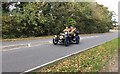
London to Brighton Veteran Car Run
A participant on the 2017 London to Brighton veteran car run.
Image: © Chris Thomas-Atkin
Taken: 5 Nov 2017
0.23 miles
9
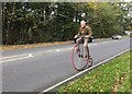
London to Brighton
On the day of the 2017 London to Brighton veteran car run not your usual participant passes by. Just under 12 miles to go to Brighton.
Image: © Chris Thomas-Atkin
Taken: 5 Nov 2017
0.23 miles
10
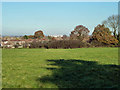
Course of Roman road 150, Burgess Hill
Margery's road 150 passed through the viewpoint and just to the left of the large white building. In the near field there are signs on aerial photographs, confirmed by a field inspection, of a series of damp lines parallel to the road course. Most of these are presumably post-Roman drainage, but two very close to the road course look rather different. It would require considerable imagination to detect a definite aggar between these parallel depressions.
Image: © Robin Webster
Taken: 26 Nov 2010
0.23 miles