Hammonds Place, Burgess Hill
Introduction
The photograph on this page of Hammonds Place, Burgess Hill by Simon Carey as part of the Geograph project.
The Geograph project started in 2005 with the aim of publishing, organising and preserving representative images for every square kilometre of Great Britain, Ireland and the Isle of Man.

There are currently over 7.5m images from over 14,400 individuals and you can help contribute to the project by visiting https://www.geograph.org.uk
Hammonds Place, Burgess Hill
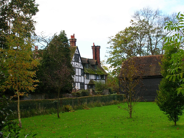
Image: © Simon Carey Taken: 5 Nov 2005
Hammonds Place was built in the 16th century. The original building was damaged by fire and it was subsequently rebuilt & added to. It was never a working farm though. Hammonds Farm was originally owned by Little Hammonds Farm House, which is situated opposite Hammonds Place tucked in just behind the barn you can see on the right. Little Hammonds Farm House (now known as Little Hammonds) dates back to the 1590's (extended in the early 1900's). The working farm was sold to developers Wates in the mid 1960's and subsequently developed in the late 1980's / early 1990's (Hammonds Ridge housing estate, Tesco, etc). In between outbuildings were used by Hammonds Place amongst others. Stabling and a large milking yard originally adjoined the house on the North Westerly corner. The barn in the picture was originally also part of the farm, it was developed into a residential dwelling in the late 1990's. Information kindly provided by Craig Maddock.
Images are licensed for reuse under creativecommons.org/licenses/by-sa/2.0
Image Location
Latitude
50.950225
Longitude
-0.14072