
IMAGES TAKEN NEAR TO
Atlas Crescent, BURGESS HILL, RH15 0XS
Introduction
This page details the photographs taken nearby to Atlas Crescent, RH15 0XS by members of the Geograph project.
The Geograph project started in 2005 with the aim of publishing, organising and preserving representative images for every square kilometre of Great Britain, Ireland and the Isle of Man.

There are currently over 7.5m images from over14,400 individuals and you can help contribute to the project by visiting https://www.geograph.org.uk
Image Map
Images are licensed for reuse under creativecommons.org/licenses/by-sa/2.0
Notes
- Clicking on the map will re-center to the selected point.
- The higher the marker number, the further away the image location is from the centre of the postcode.
Image Listing (23 Images Found)
Images are licensed for reuse under creativecommons.org/licenses/by-sa/2.0
Image
Details
Distance
1
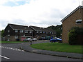
Longhurst
Small cul-de-sac off Kings Way on the eastern side of Burgess Hill.
Image: © Simon Carey
Taken: 16 Aug 2009
0.13 miles
2
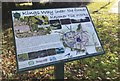
Information board on Kings Way
A close look at the Green Circle Network information board on Kings Way in Burgess Hill.
Image: © Chris Thomas-Atkin
Taken: 5 Nov 2017
0.14 miles
3
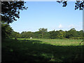
North Howser
The name of the field according to the 1843 tithe map. Viewed from Ditchling Common Country Park the land now belongs to Ditchling Common Stud.
Image: © Simon Carey
Taken: 28 Aug 2009
0.14 miles
4
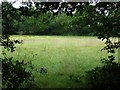
Little Fullers Field
The name of the field according to the 1843 tithe map and formerly part of Frankbarrow, a medieval deer park that was disparked in the 1530s.
Image: © Simon Carey
Taken: 16 Aug 2009
0.15 miles
5
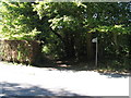
Bridleway through the outskirts of Burgess Hill
On the right of the path is a clay pit and brickworks.
Image: © Dave Spicer
Taken: 7 Sep 2012
0.15 miles
6
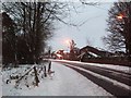
Kings Way towards Rolfe Drive
Taken from the point where a public footpath is intersected by Kings Way.
Image: © Curtis Bateman
Taken: 9 Jan 2010
0.18 miles
7
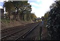
Railway Line to Lewes
The main line at a crossing point of a bridleway in Burgess Hill.
Image: © Chris Thomas-Atkin
Taken: 5 Nov 2017
0.18 miles
8
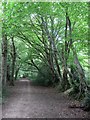
Bridleway to Ditchling Common
An old route judging by the embankments with trees marking field boundaries either side. The original bridleway left Keymer Road next to what is now the junction with Folders Lane but is now built over though its path can be traced. The eastern end is the only remaining part in its original state.
Image: © Simon Carey
Taken: 16 Aug 2009
0.19 miles
9
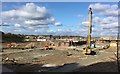
Building work at the Keymer Tile Works
The large machine in view on the building site on the former Keymer Tile Works is probably used for piling work. This site is a major location for new housing in Burgess Hill, which is taking place on the old Tile Works site and the adjacent Clay Pits that provided the material.
Image: © Chris Thomas-Atkin
Taken: 5 Nov 2017
0.19 miles
10
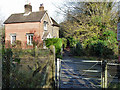
Bridleway level crossing and cottage
Although this was the only public crossing in the neighbourhood in former times, it seems unlikely it merited a crossing keeper, although the cottage appears to be, or have been, on railway land.
Image: © Robin Webster
Taken: 19 Nov 2010
0.19 miles