
IMAGES TAKEN NEAR TO
Unicorn Way, RH15 0WB
Introduction
This page details the photographs taken nearby to Unicorn Way, RH15 0WB by members of the Geograph project.
The Geograph project started in 2005 with the aim of publishing, organising and preserving representative images for every square kilometre of Great Britain, Ireland and the Isle of Man.

There are currently over 7.5m images from over14,400 individuals and you can help contribute to the project by visiting https://www.geograph.org.uk
Image Map
Images are licensed for reuse under creativecommons.org/licenses/by-sa/2.0
Notes
- Clicking on the map will re-center to the selected point.
- The higher the marker number, the further away the image location is from the centre of the postcode.
Image Listing (20 Images Found)
Images are licensed for reuse under creativecommons.org/licenses/by-sa/2.0
Image
Details
Distance
1
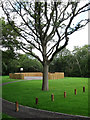
Play Area, Folders Keep
Part of a new development still being completed on land formerly part of nearby Folders Farm. The basketball/football area is still pristine as it is still fenced off.
Image: © Simon Carey
Taken: 16 Aug 2009
0.13 miles
2
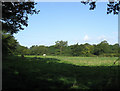
North Howser
The name of the field according to the 1843 tithe map. Viewed from Ditchling Common Country Park the land now belongs to Ditchling Common Stud.
Image: © Simon Carey
Taken: 28 Aug 2009
0.15 miles
3
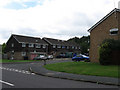
Longhurst
Small cul-de-sac off Kings Way on the eastern side of Burgess Hill.
Image: © Simon Carey
Taken: 16 Aug 2009
0.17 miles
4
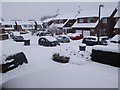
Ruspers
Looking towards the junction of Ruspers and Cold Waltham Lane, Burgess Hill.
Image: © Curtis Bateman
Taken: 7 Jan 2010
0.17 miles
5
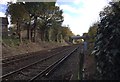
Railway Line to Lewes
The main line at a crossing point of a bridleway in Burgess Hill.
Image: © Chris Thomas-Atkin
Taken: 5 Nov 2017
0.19 miles
6
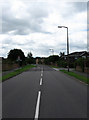
Kings Way
Main arterial road through the new suburbs of eastern Burgess Hill that grew up in the 1980s and 90s. A public footpath crosses the road straight ahead a reminder of the rural origins of this area which once belonged to the parish of Ditchling.
Image: © Simon Carey
Taken: 16 Aug 2009
0.19 miles
7
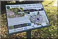
Information board on Kings Way
A close look at the Green Circle Network information board on Kings Way in Burgess Hill.
Image: © Chris Thomas-Atkin
Taken: 5 Nov 2017
0.20 miles
8
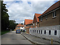
Sycamore Drive
Part of the new development called Folders Keep which is currently in the process of being built with some houses already occupied and others nearing completion. Built on land formerly part of Folders Farm the trees on the left are former field boundaries that now demarcate one housing estate from another as the eastward expansion of Burgess Hill reaches the railway line. According to the tithe map this was once a field called North Field which was already severely truncated by the railway before it became lost under new housing.
Image: © Simon Carey
Taken: 16 Aug 2009
0.20 miles
9
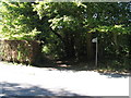
Bridleway through the outskirts of Burgess Hill
On the right of the path is a clay pit and brickworks.
Image: © Dave Spicer
Taken: 7 Sep 2012
0.21 miles
10
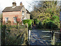
Bridleway level crossing and cottage
Although this was the only public crossing in the neighbourhood in former times, it seems unlikely it merited a crossing keeper, although the cottage appears to be, or have been, on railway land.
Image: © Robin Webster
Taken: 19 Nov 2010
0.21 miles