
IMAGES TAKEN NEAR TO
Bassells Lane, HORSHAM, RH13 8NG
Introduction
This page details the photographs taken nearby to Bassells Lane, RH13 8NG by members of the Geograph project.
The Geograph project started in 2005 with the aim of publishing, organising and preserving representative images for every square kilometre of Great Britain, Ireland and the Isle of Man.

There are currently over 7.5m images from over14,400 individuals and you can help contribute to the project by visiting https://www.geograph.org.uk
Image Map
Images are licensed for reuse under creativecommons.org/licenses/by-sa/2.0
Notes
- Clicking on the map will re-center to the selected point.
- The higher the marker number, the further away the image location is from the centre of the postcode.
Image Listing (31 Images Found)
Images are licensed for reuse under creativecommons.org/licenses/by-sa/2.0
Image
Details
Distance
1
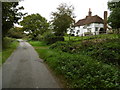
Bassells Farm and Rookcross Lane
Bassels Lane (with one L) leads off Rookcross Lane just ahead on the right past Bassells Farmhouse (with two Ls).
Image: © Marathon
Taken: 17 Oct 2015
0.00 miles
2
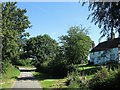
Bassells Farmhouse, Rookcross Lane
A farmhouse dating back to the 17th century located at the junction of Rookcross Lane and Bassells Lane.
Image: © Simon Carey
Taken: 9 Aug 2016
0.01 miles
3
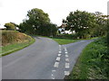
Bassels Farm
Which way? Junction of Rockcross lane and Bassels Lane.
Image: © The Saunterer
Taken: 6 Oct 2012
0.01 miles
4
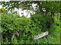
Cottage at the junction between Bassells Lane and Rookcross Lane
Image: © Dave Spicer
Taken: 9 May 2009
0.02 miles
5
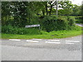
Bassells Lane
Situated a few hundred yards south of Bay Bridge, off the A24
Image: © Dave Spicer
Taken: 9 May 2009
0.02 miles
6
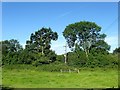
Rock Croft Lag (1)
The name of the field according to West Grinstead's 1841 tithe map and one of three of the same name that lie between a small stream to the west and Rookcross Lane to the east. To the south is Image whilst to the north is Image
Image: © Simon Carey
Taken: 9 Aug 2016
0.04 miles
7
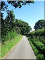
Rookcross Lane
A public highway linking the A24 to Rookcross Farm. South of the latter the lane continues albeit as a private road to Hobshorts Farm. This section is located to the south of Image with Image beyond the hedge to the left.
Image: © Simon Carey
Taken: 9 Aug 2016
0.06 miles
8
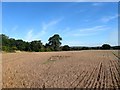
Five Acres/Barn Field
The name of the fields according to West Grinstead's 1841 tithe map that have been combined along with Image to the east, Image to the south and Image to the south east. Barn Field is at the northern end adjacent to Bassells Lane with Image to its east whilst Five Acres is in the foreground.
Image: © Simon Carey
Taken: 23 Sep 2016
0.09 miles
9
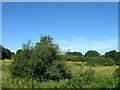
Pitch Pond/Garden Ground
The name of the fields according to West Grinstead's 1841 tithe map that are separated by a small stream, a tributary of the River Adur. Pitch Pond was in the foreground on the eastern side adjacent to Rookcross Lane whilst Garden Ground was to the west next to the modern A24. The former suggests the ground was once a pond. To the south east is Image
Image: © Simon Carey
Taken: 9 Aug 2016
0.09 miles
10
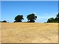
North Field
The name of the field according to West Grinstead's 1841 tithe map that has been merged with a number of others to the south to form one large field. Bassells Lane is to the north.
Image: © Simon Carey
Taken: 9 Aug 2016
0.10 miles