
IMAGES TAKEN NEAR TO
Lock Lane, HORSHAM, RH13 8EG
Introduction
This page details the photographs taken nearby to Lock Lane, RH13 8EG by members of the Geograph project.
The Geograph project started in 2005 with the aim of publishing, organising and preserving representative images for every square kilometre of Great Britain, Ireland and the Isle of Man.

There are currently over 7.5m images from over14,400 individuals and you can help contribute to the project by visiting https://www.geograph.org.uk
Image Map
Images are licensed for reuse under creativecommons.org/licenses/by-sa/2.0
Notes
- Clicking on the map will re-center to the selected point.
- The higher the marker number, the further away the image location is from the centre of the postcode.
Image Listing (35 Images Found)
Images are licensed for reuse under creativecommons.org/licenses/by-sa/2.0
Image
Details
Distance
1
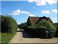
Woodsmiths, Lock Farm
A former farm office that was converted into a dwelling during the 1990s. To the east are Lock Farm Cottages which are obscured by the residence in the foreground.
Image: © Simon Carey
Taken: 23 Sep 2016
0.00 miles
2
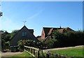
1, Lock Farm Cottages
One of three built sometime between the wars. This one is located next to the bridleway and is the easternmost of three.
Image: © Simon Carey
Taken: 30 Aug 2016
0.03 miles
4
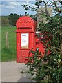
Georgian Post
A Georgian Post Box RH13 183 Lock Estate
Image: © The Saunterer
Taken: 30 Apr 2012
0.06 miles
5
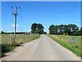
Lock Lane
The private road becomes private along this stretch with the bridleway turning southwards to go through the middle of the farm. It rejoins another public footpath at the junction at the far end where the lane heads north to access the dwellings around the former Grants Farm. It is interesting that the bridleways and footpaths going through the farm have not actually been diverted along here but keep to their original routes.
Image: © Simon Carey
Taken: 30 Aug 2016
0.07 miles
6
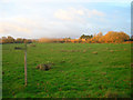
Morning Light on Locks Farm
Viewed from the footpath that links Partridge Green to the River Adur.
Image: © Simon Carey
Taken: 22 Nov 2008
0.08 miles
7
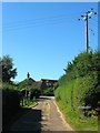
Lock Farm House
The old farmhouse dates from 1702 and is located to the east of the current farm complex.
Image: © Simon Carey
Taken: 30 Aug 2016
0.08 miles
9
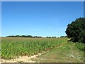
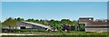
Fry Field/New Limekiln Field
The name of the fields according to Ashurst's 1844 tithe map that have been combined along with Image and Image to the west to form a much larger unit. Fry Field was in the foreground and actually straddled the old parish boundary between West Grinstead and Ashurst whilst New Limekiln Field was further north.
Image: © Simon Carey
Taken: 30 Aug 2016
0.09 miles
10
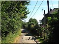
Ham Cottages
A semi-detached pair of cottages at the southern end of the Lock Farm complex. They appear to be either extensions of the original 19th century Lock Cottages that were marked on OS maps from 1875-1911 or rebuilds.
Image: © Simon Carey
Taken: 30 Aug 2016
0.13 miles