
IMAGES TAKEN NEAR TO
Wantage Road, HUNGERFORD, RG17 7DG
Introduction
This page details the photographs taken nearby to Wantage Road, RG17 7DG by members of the Geograph project.
The Geograph project started in 2005 with the aim of publishing, organising and preserving representative images for every square kilometre of Great Britain, Ireland and the Isle of Man.

There are currently over 7.5m images from over14,400 individuals and you can help contribute to the project by visiting https://www.geograph.org.uk
Image Map
Images are licensed for reuse under creativecommons.org/licenses/by-sa/2.0
Notes
- Clicking on the map will re-center to the selected point.
- The higher the marker number, the further away the image location is from the centre of the postcode.
Image Listing (14 Images Found)
Images are licensed for reuse under creativecommons.org/licenses/by-sa/2.0
Image
Details
Distance
1
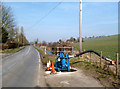
Pumping at Great Shefford
The Shefford Stream, an ephemeral river which appears in this valley only when groundwater levels are exceptionally high, is flowing well this year.
The stream is culverted under part of the village, but on several occasions the structures installed have proved to be too small to take the flow and flooding has occurred.
There is another pipeline bypassing the village and it has been possible to divert a part of the flow into this by pumping.
Image: © Des Blenkinsopp
Taken: 4 Mar 2013
0.07 miles
2
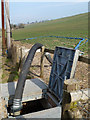
Pumping at Great Shefford 2
This is the outfall of the pump installation shown in Image
The Shefford Stream is culverted beneath part of the village, but the structures are insufficient for high flows and flooding has happened in the past.
Some of the water is being pumped out of the stream into a pipeline that bypasses the village.
Image: © Des Blenkinsopp
Taken: 4 Mar 2013
0.07 miles
3
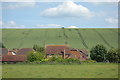
Crop Marks beyond the Houses
Housing in the bottom of the valley at Great Shefford with the cultivated valley side beyond.
Image: © Des Blenkinsopp
Taken: 14 Jun 2017
0.13 miles
4
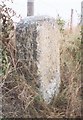
Old Milestone by the A338 in Great Shefford
Carved stone post by the A338, in parish of Great Shefford (West Berkshire District), Wantage Road; opposite bungalow "Meadowside", on steep grass bank by wire fence, on East side of road. Besselsleigh tombstone, erected by the Besselsleigh turnpike trust in the 18th century.
Inscription reads:-
To
WANTAGE
8
HUNGERFORD
5½
Carved benchmark and rivet on top.
Grade II listed.
List Entry Number: 1321843 https://historicengland.org.uk/listing/the-list/list-entry/1321843
Milestone Society National ID: BE_WAHG08
Image: © A Rosevear
Taken: 22 Sep 2001
0.14 miles
5
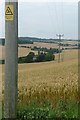
Farmland north of Great Shefford
The gentler slopes either side of the A338, seen in the valley, are mainly arable farmland, such as this crop of wheat.
Image: © Graham Horn
Taken: 25 Jul 2008
0.14 miles
6
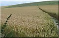
Footpath through the wheat
This wheat crop has been kept well clear from the footpath, which climbs obliquely away from the A338 through the village.
Image: © Graham Horn
Taken: 25 Jul 2008
0.17 miles
7
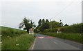
Great Shefford village entrance
A speed limit and the appearance of gates on the A338 to the north of the village
Image: © David Smith
Taken: 9 Jun 2018
0.17 miles
8
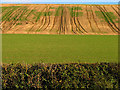
Patterned Farmland near Great Shefford
The square is all farmland. These interesting lines of differing vegetation and crops and plough lines made an interesting landscape for the entire section along the road to Great Shefford, in this square.
Image: © Pam Brophy
Taken: 1 Nov 2005
0.18 miles
9
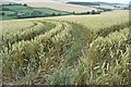
Patterns in the wheat
These are patterns simply caused by the tractor turning at the end of the row, not part of a crop "circle".
Image: © Graham Horn
Taken: 25 Jul 2008
0.19 miles
10
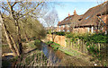
Shefford Stream by Spring Meadows
A small tributary of the Lambourn, which is flowing well this year after a very wet winter. Spring Meadows is the nearby street name. Whether that's for the stream or the season I'm not sure.
Image: © Des Blenkinsopp
Taken: 16 Mar 2020
0.19 miles