Pumping at Great Shefford 2
Introduction
The photograph on this page of Pumping at Great Shefford 2 by Des Blenkinsopp as part of the Geograph project.
The Geograph project started in 2005 with the aim of publishing, organising and preserving representative images for every square kilometre of Great Britain, Ireland and the Isle of Man.

There are currently over 7.5m images from over 14,400 individuals and you can help contribute to the project by visiting https://www.geograph.org.uk
Pumping at Great Shefford 2
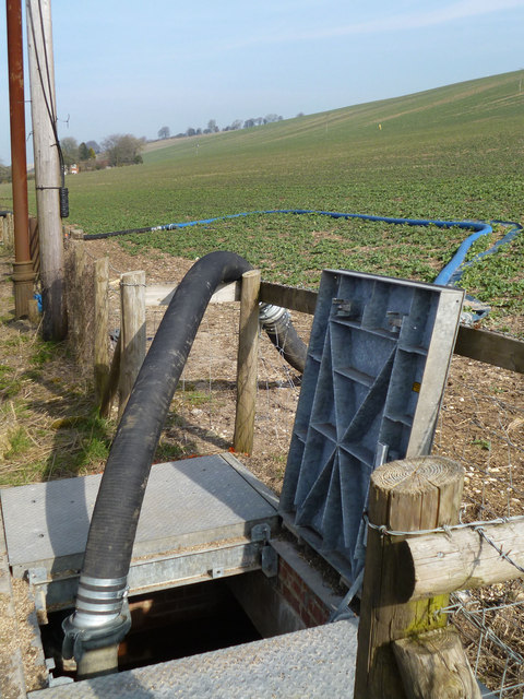
Image: © Des Blenkinsopp Taken: 4 Mar 2013
This is the outfall of the pump installation shown in Image The Shefford Stream is culverted beneath part of the village, but the structures are insufficient for high flows and flooding has happened in the past. Some of the water is being pumped out of the stream into a pipeline that bypasses the village.
Images are licensed for reuse under creativecommons.org/licenses/by-sa/2.0
Image Location
Latitude
51.479105
Longitude
-1.440958