
IMAGES TAKEN NEAR TO
Wyndale Avenue, LONDON, NW9 9PT
Introduction
This page details the photographs taken nearby to Wyndale Avenue, NW9 9PT by members of the Geograph project.
The Geograph project started in 2005 with the aim of publishing, organising and preserving representative images for every square kilometre of Great Britain, Ireland and the Isle of Man.

There are currently over 7.5m images from over14,400 individuals and you can help contribute to the project by visiting https://www.geograph.org.uk
Image Map
Images are licensed for reuse under creativecommons.org/licenses/by-sa/2.0
Notes
- Clicking on the map will re-center to the selected point.
- The higher the marker number, the further away the image location is from the centre of the postcode.
Image Listing (85 Images Found)
Images are licensed for reuse under creativecommons.org/licenses/by-sa/2.0
Image
Details
Distance

2
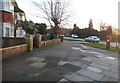
Wyndale Avenue at the corner of Fryent Way
Image: © David Howard
Taken: 8 Jan 2015
0.09 miles
3

Fryent Way, Kingsbury
On the railway bridge over the Jubilee Line
Image: © David Howard
Taken: 8 Jan 2015
0.09 miles
4
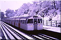
Jubilee Line in snow at Kingsbury
A wintry scene at Kingsbury station on London Underground's Jubilee Line.
Image: © Malc McDonald
Taken: 6 Feb 1986
0.11 miles
5
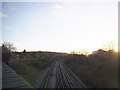
The Jubilee Line between Kingsbury and Wembley Park
On Fryent Way, just south of Kingsbury Station
Image: © David Howard
Taken: 8 Jan 2015
0.11 miles
6
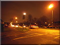
Waltham Avenue at the junction of Fryent Way
Image: © David Howard
Taken: 20 Dec 2013
0.11 miles
7
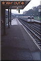
Kingsbury Underground Station
A train for Stanmore arrives at Kingsbury on a grey day in March 1981. The line here was opened in 1932 as a branch of the Metropolitan Railway; Kingsbury is a typical London suburb of the inter-war era and railway construction went hand-in-hand with house building. The line was later to become a part of the Bakerloo Line and, in 1979, the Jubilee Line. The bridge in the distance carries Fryent Way.
Image: © Stephen McKay
Taken: Unknown
0.13 miles
8

Houses on Valley Drive backing onto Fryent Park
Image: © David Howard
Taken: 23 Sep 2015
0.14 miles
9

Tudorbethan in Kingsbury
This is Metro-land and John Betjeman would doubtless have known this area. This style of housing is known as 'Tudorbethan'.
In the 1930s the Metropolitan Estates Company informed prospective buyers in Kingsbury that "Peace and quiet prevail and the stretches of country around offer plenty of opportunity for invigorating exercise to those who are inclined to walking and cycling." One developer even called Kingsbury "the Queen of north-west London suburbs". By the end of the 1930s the station at Kingsbury and its flanking shops were swamped by a huge length of shopping arcades, and there were even two cinemas.
Image: © Marathon
Taken: 1 Jul 2015
0.14 miles
10

The backs of houses on Valley Drive, Fryent Country Park
Image: © David Howard
Taken: 15 Aug 2013
0.14 miles