Kingsbury Underground Station
Introduction
The photograph on this page of Kingsbury Underground Station by Stephen McKay as part of the Geograph project.
The Geograph project started in 2005 with the aim of publishing, organising and preserving representative images for every square kilometre of Great Britain, Ireland and the Isle of Man.

There are currently over 7.5m images from over 14,400 individuals and you can help contribute to the project by visiting https://www.geograph.org.uk
Kingsbury Underground Station
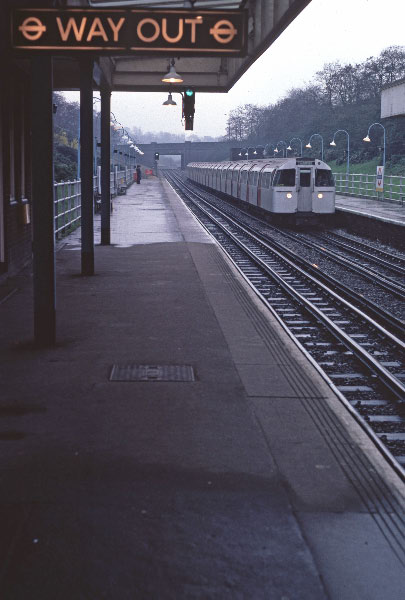
Image: © Stephen McKay Taken: Unknown
A train for Stanmore arrives at Kingsbury on a grey day in March 1981. The line here was opened in 1932 as a branch of the Metropolitan Railway; Kingsbury is a typical London suburb of the inter-war era and railway construction went hand-in-hand with house building. The line was later to become a part of the Bakerloo Line and, in 1979, the Jubilee Line. The bridge in the distance carries Fryent Way.
Images are licensed for reuse under creativecommons.org/licenses/by-sa/2.0
Image Location
Latitude
51.584168
Longitude
-0.278787