IMAGES TAKEN NEAR TO
Valley Drive, LONDON, NW9 9NP
Introduction
This page details the photographs taken nearby to Valley Drive, NW9 9NP by members of the Geograph project.
The Geograph project started in 2005 with the aim of publishing, organising and preserving representative images for every square kilometre of Great Britain, Ireland and the Isle of Man.

There are currently over 7.5m images from over14,400 individuals and you can help contribute to the project by visiting https://www.geograph.org.uk
Image Map
Images are licensed for reuse under creativecommons.org/licenses/by-sa/2.0
Notes
- Clicking on the map will re-center to the selected point.
- The higher the marker number, the further away the image location is from the centre of the postcode.
Image Listing (155 Images Found)
Images are licensed for reuse under creativecommons.org/licenses/by-sa/2.0
Image
Details
Distance
2
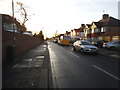
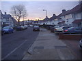
Crundale Avenue
Taken from the bend in Crundale Avenue, a hazard for speeding cars.
1930s houses line its western side (left of the photo) and older Tudorbethan houses its eastern (right of the photo). The western side sits at lower ground level and is more prone to flooding.
Image: © Watling
Taken: 2 Feb 2009
0.10 miles
3
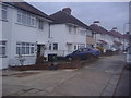
Houses on Crundale Avenue, Kingsbury
These are typical art deco 1930s semi-detached, although none of the original Crittall windows are left, and one is stone clad.
Image: © David Howard
Taken: 12 Dec 2012
0.11 miles
5
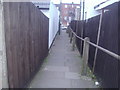
Path between Crundale Avenue and Kingsbury Road
This leads to a service road behind the shops with a car park.
Image: © David Howard
Taken: 12 Dec 2012
0.12 miles
6
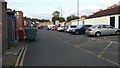
Alleyway behind Kingsbury Road
The car park used to be free but nowadays very little is.
Image: © David Howard
Taken: 10 Aug 2016
0.12 miles
7
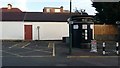
Have you been?
One of the few remaining local toilets was converted to a tardis some years ago, while as far as I know the free toilet in adjacent Kingsbury Station (and most others in tube stations) have been closed.
Image: © David Howard
Taken: 10 Aug 2016
0.12 miles
8

Tudorbethan in Kingsbury
This is Metro-land and John Betjeman would doubtless have known this area. This style of housing is known as 'Tudorbethan'.
In the 1930s the Metropolitan Estates Company informed prospective buyers in Kingsbury that "Peace and quiet prevail and the stretches of country around offer plenty of opportunity for invigorating exercise to those who are inclined to walking and cycling." One developer even called Kingsbury "the Queen of north-west London suburbs". By the end of the 1930s the station at Kingsbury and its flanking shops were swamped by a huge length of shopping arcades, and there were even two cinemas.
Image: © Marathon
Taken: 1 Jul 2015
0.13 miles
9
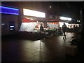
Shops on Kingsbury Road
It looks like late night but it's 4.50pm on the shortest day
Image: © David Howard
Taken: 21 Dec 2019
0.13 miles