
IMAGES TAKEN NEAR TO
Woodberry Close, LONDON, NW7 1GD
Introduction
This page details the photographs taken nearby to Woodberry Close, NW7 1GD by members of the Geograph project.
The Geograph project started in 2005 with the aim of publishing, organising and preserving representative images for every square kilometre of Great Britain, Ireland and the Isle of Man.

There are currently over 7.5m images from over14,400 individuals and you can help contribute to the project by visiting https://www.geograph.org.uk
Image Map
Images are licensed for reuse under creativecommons.org/licenses/by-sa/2.0
Notes
- Clicking on the map will re-center to the selected point.
- The higher the marker number, the further away the image location is from the centre of the postcode.
Image Listing (121 Images Found)
Images are licensed for reuse under creativecommons.org/licenses/by-sa/2.0
Image
Details
Distance
1

Lidbury Square, Mill Hill
Lidbury Square is part of a recent upmarket development just west of Mill Hill East station. This is a view east along the road. The shadow in the foreground is that of one of the pillars that marks the entrance to this "select" development.
Image: © Nigel Mykura
Taken: 27 Sep 2009
0.02 miles
2
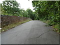
Bridge over what was to be an extension of the Northern line
The line between what is now Finsbury Park and Edgware was opened by the Great Northern Railway on the 22nd August 1867. In the London Passenger Transport Board's 'New Works Plan' of 1935 it was proposed that the line be taken over by the Northern line and be diverted into the new Underground station at Edgware which had opened in 1924. The service on the line from East Finchley to Edgware was suspended from 11th September 1939 to allow the work to be completed and the New Works Plan was expected to be completed by spring 1941. In the event the Northern line branch never got past Mill Hill East and so 11th September 1939 was the last day the line was used by passenger trains. Northern line trains first served Mill Hill East on 18th May 1941. The line was closed completely beyond Mill Hill East on 1st June 1964. This view is across the first bridge over the former line beyond the buffers at Mill Hill East seen at http://www.geograph.org.uk/photo/5099651 Much of the former trackbed is now a linear parkland walk.
For a history of Mill Hill east station see https://en.wikipedia.org/wiki/Mill_Hill_East_tube_station and for the line beyond Mill Hill East see http://www.abandonedstations.org.uk/Northern_Heights_9.html
Image: © Marathon
Taken: 31 Aug 2016
0.05 miles
3
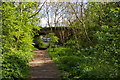
Bridge over disused railway line, Mill Hill
The path follows the former railway line from Mill Hill East to Edgware, which would have become part of the London Underground Northern Line under the 1930s New Works programme (specifically the Northern Heights scheme) were it not for the intervention of war.
Image: © Christopher Hilton
Taken: 19 Apr 2017
0.05 miles
4
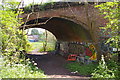
Bridge over disused railway line, Mill Hill
The bridge crosses the former railway line from Mill Hill East to Edgware, which would have become part of the London Underground Northern Line under the 1930s New Works programme (specifically the Northern Heights scheme) were it not for the intervention of war.
Image: © Christopher Hilton
Taken: 19 Apr 2017
0.05 miles
5
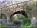
The Sanders Lane bridge over the former Mill Hill East to Edgware railway line
See Image
Image: © Mike Quinn
Taken: 26 Feb 2020
0.06 miles
6
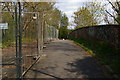
Bridge over disused railway line, Mill Hill
The bridge crosses the former railway line from Mill Hill East to Edgware, which would have become part of the London Underground Northern Line under the 1930s New Works programme (specifically the Northern Heights scheme) were it not for the intervention of war.
Image: © Christopher Hilton
Taken: 19 Apr 2017
0.06 miles
7
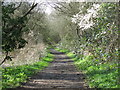
The course of the former Mill Hill East to Edgware railway line west of Sanders Lane
See Image
Image: © Mike Quinn
Taken: 26 Feb 2020
0.06 miles
8
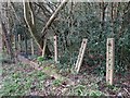
Cable posts by the former Mill Hill East to Edgware railway line
See Image
Image: © Mike Quinn
Taken: 26 Feb 2020
0.06 miles
10
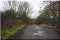
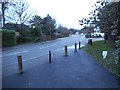
Sanders Lane Bridge
On the bridge looking along Sanders Lane towards Tavistock Avenue. The road has been a footpath for many years. Note that the parapet of the bridge on the right has been removed, although the cap stones, like those on the left, have been replaced and a chainlink fence has been added. I wonder if demolition work began but was abandoned? Barnet's corporate plan includes proposals to reopen Sanders Lane to through traffic by 2011. Under the proposals this bridge will be replaced.
Image: © Martin Addison
Taken: 19 Jan 2009
0.06 miles