Sanders Lane Bridge
Introduction
The photograph on this page of Sanders Lane Bridge by Martin Addison as part of the Geograph project.
The Geograph project started in 2005 with the aim of publishing, organising and preserving representative images for every square kilometre of Great Britain, Ireland and the Isle of Man.

There are currently over 7.5m images from over 14,400 individuals and you can help contribute to the project by visiting https://www.geograph.org.uk
Sanders Lane Bridge
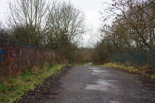
Image: © Martin Addison Taken: 19 Jan 2009
On the bridge looking along Sanders Lane towards Tavistock Avenue. The road has been a footpath for many years. Note that the parapet of the bridge on the right has been removed, although the cap stones, like those on the left, have been replaced and a chainlink fence has been added. I wonder if demolition work began but was abandoned? Barnet's corporate plan includes proposals to reopen Sanders Lane to through traffic by 2011. Under the proposals this bridge will be replaced.
Images are licensed for reuse under creativecommons.org/licenses/by-sa/2.0
Image Location
Latitude
51.608572
Longitude
-0.214897