IMAGES TAKEN NEAR TO
Adelaide Road, LONDON, NW3 3QB
Introduction
This page details the photographs taken nearby to Adelaide Road, NW3 3QB by members of the Geograph project.
The Geograph project started in 2005 with the aim of publishing, organising and preserving representative images for every square kilometre of Great Britain, Ireland and the Isle of Man.

There are currently over 7.5m images from over14,400 individuals and you can help contribute to the project by visiting https://www.geograph.org.uk
Image Map
Images are licensed for reuse under creativecommons.org/licenses/by-sa/2.0
Notes
- Clicking on the map will re-center to the selected point.
- The higher the marker number, the further away the image location is from the centre of the postcode.
Image Listing (423 Images Found)
Images are licensed for reuse under creativecommons.org/licenses/by-sa/2.0
Image
Details
Distance
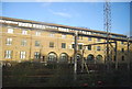
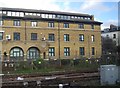
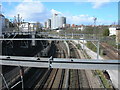
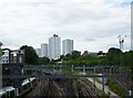
3
Ainger Road
Railway lines run behind the wall.
Image: © DS Pugh
Taken: 8 Dec 2017
0.05 miles
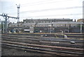
4
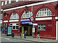
Chalk Farm Underground Station
The name 'Chalk Farm' is often said to be a corruption of 'Chalcot Farm', which is supposed to have been located in this area before it was built up. However, Cyril Harris in his book 'What's in a name?' (Capital Transport Publishing, 2001) says that there is no evidence of a farm ever existing here, and that the name, recorded as Chaldecote in 1253, may be derived from cold cottages, referring to the bleak and exposed nature of the area in those days. Whatever the truth may be, the name certainly does not refer to chalk - this area is firmly sited on London clay.
Image: © Stephen McKay
Taken: 3 Aug 2006
0.05 miles
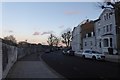
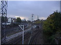
5
View From Footbridge Over West Coast Main Line
Looking towards Swiss Cottage. Unless you are over 7 feet tall you won't be able to see any of this view on foot -- the sides of the footbridge are too high.
Image: © Danny P Robinson
Taken: 18 Mar 2007
0.05 miles
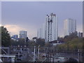
7
The railway lines and flats from Primrose Hill footbridge
After being reduced to a single train out and back a day, British Rail closed Primrose Hill station in 1992, citing 'lack of usage' in order to carry out their wishes. The station building was just behind me by the bridge.
Image: © David Howard
Taken: 30 Oct 2008
0.06 miles
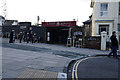
9
Rail Lines from Rail bridge, Regent's Park Road NW1
Image: © Robin Sones
Taken: 12 Aug 2013
0.06 miles
10
Flats in Primrose Hill from the railway bridge
Image: © David Howard
Taken: 30 Oct 2008
0.07 miles