Chalk Farm Underground Station
Introduction
The photograph on this page of Chalk Farm Underground Station by Stephen McKay as part of the Geograph project.
The Geograph project started in 2005 with the aim of publishing, organising and preserving representative images for every square kilometre of Great Britain, Ireland and the Isle of Man.

There are currently over 7.5m images from over 14,400 individuals and you can help contribute to the project by visiting https://www.geograph.org.uk
Chalk Farm Underground Station
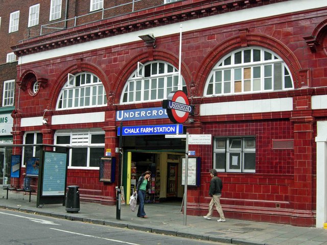
Image: © Stephen McKay Taken: 3 Aug 2006
The name 'Chalk Farm' is often said to be a corruption of 'Chalcot Farm', which is supposed to have been located in this area before it was built up. However, Cyril Harris in his book 'What's in a name?' (Capital Transport Publishing, 2001) says that there is no evidence of a farm ever existing here, and that the name, recorded as Chaldecote in 1253, may be derived from cold cottages, referring to the bleak and exposed nature of the area in those days. Whatever the truth may be, the name certainly does not refer to chalk - this area is firmly sited on London clay.
Images are licensed for reuse under creativecommons.org/licenses/by-sa/2.0
Image Location
Latitude
51.54309
Longitude
-0.155593