
IMAGES TAKEN NEAR TO
Mora Road, LONDON, NW2 6PT
Introduction
This page details the photographs taken nearby to Mora Road, NW2 6PT by members of the Geograph project.
The Geograph project started in 2005 with the aim of publishing, organising and preserving representative images for every square kilometre of Great Britain, Ireland and the Isle of Man.

There are currently over 7.5m images from over14,400 individuals and you can help contribute to the project by visiting https://www.geograph.org.uk
Image Map
Images are licensed for reuse under creativecommons.org/licenses/by-sa/2.0
Notes
- Clicking on the map will re-center to the selected point.
- The higher the marker number, the further away the image location is from the centre of the postcode.
Image Listing (88 Images Found)
Images are licensed for reuse under creativecommons.org/licenses/by-sa/2.0
Image
Details
Distance
1

Cricklewood Pumping Station
Located between St. Michael's Road and the Dudding Hill Loop railway line connecting Cricklewood with Acton, opposite St.Michael's Church.
The station forms part of the Metropolitan Water Board's north London network of supply and is on the 42" and 48" mains that connect with the Lea Valley and the Waterworks at Kempton Park. See Image for part of the route through Southall and Image for part of the route through Golders Green.
Image: © Martin Addison
Taken: 23 Oct 2009
0.02 miles
2
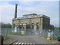
Cricklewood Water Pumping Station off St Michael's Road, London NW2
Image: © Robin Sones
Taken: 24 Apr 2007
0.02 miles
3
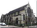
St. Michael's Church of Jesus Christ (Apostolic), St. Michael's Road / Mora Road, NW2
Image: © Mike Quinn
Taken: 2 Aug 2011
0.03 miles
4
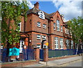
SE side of Mora Primary and Nursery School, Cricklewood
Viewed along Mora Road. The school, dating from 1907, is multicultural and multifaith.
Image: © Jaggery
Taken: 12 May 2012
0.04 miles
5
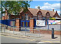
Western side of Mora Primary and Nursery School, Cricklewood
The school, dating from 1907, is at the western end of Mora Road. The school is multicultural and multifaith. The large banner on the railings is part of a campaign to encourage children to walk to school at least once a week.
Image: © Jaggery
Taken: 12 May 2012
0.04 miles
6
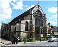
St Michaels Church of Jesus Christ (Apostolic), Cricklewood
Located on the corner of St Michaels Road and Mora Road. Built as the church of Saint Michael in the early 20th century. The foundation stone http://www.geograph.org.uk/photo/1745855 shows June 26th 1909.
Image: © Jaggery
Taken: 12 May 2012
0.04 miles
7
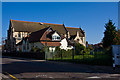
Living Spring
An apt choice of name for the Montessori Nursery School occupying the church hall of St. Michael's Church of Jesus Christ. It sits beside a strip of land (on the right) that carries the 42" and 48" Watermains that connect Cricklewood Pumping Station, across the road, with Golders Green and Hampstead Garden Suburb - see Image See also http://middlesexcountycouncil.org.uk/index.php?option=com_content&task=view&id=16&Itemid=35 for a diagram of the route and some commentary.
Image: © Martin Addison
Taken: 23 Oct 2009
0.04 miles
9
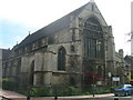
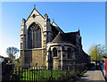
St Michael's Church, St Michael's Road at Junction with Mora Road, London NW2
Image: © Robin Sones
Taken: 24 Apr 2007
0.05 miles
10
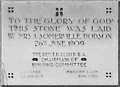
St Michael, Mora Road, London NW2 - Foundation stone
Image: © John Salmon
Taken: 13 Nov 2004
0.05 miles