
IMAGES TAKEN NEAR TO
Orchard Close, LONDON, NW2 6JF
Introduction
This page details the photographs taken nearby to Orchard Close, NW2 6JF by members of the Geograph project.
The Geograph project started in 2005 with the aim of publishing, organising and preserving representative images for every square kilometre of Great Britain, Ireland and the Isle of Man.

There are currently over 7.5m images from over14,400 individuals and you can help contribute to the project by visiting https://www.geograph.org.uk
Image Map
Images are licensed for reuse under creativecommons.org/licenses/by-sa/2.0
Notes
- Clicking on the map will re-center to the selected point.
- The higher the marker number, the further away the image location is from the centre of the postcode.
Image Listing (53 Images Found)
Images are licensed for reuse under creativecommons.org/licenses/by-sa/2.0
Image
Details
Distance
1
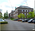
Chartwell Court, 151 Brook Road, Dollis Hill
Now in use as flats, this was formerly the Post Office Research Station where Colossus was built by a team led by Tommy Flowers. Colossus was the world's first digital electronic programmable computer. Colossus and its successors were used by code breakers at Bletchley Park to decrypt German messages during the Second World War. The computer used thermionic valves (vacuum tubes) to perform the calculations. A nearby street is named Flowers Close in honour of the team leader.
Image: © Jaggery
Taken: 12 May 2012
0.03 miles
2
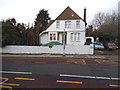
Detached house on Dollis Hill Lane
The houses along here begin with a few Victorian to present day, with most in the entire area all built in the 1930s.
Image: © David Howard
Taken: 22 Jan 2014
0.05 miles
3
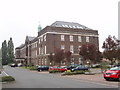
Dollis Hill, former Post Office Research Station
This is now Chartwell Court flats. It was built in 1933 as the Post Office Research Station, which included telecommunications research. The history section of the BT website http://www.btplc.com tells us that:
"What is generally regarded as the world's first programmable electronic computer (Colossus) was designed and constructed by a Post Office Research Branch team headed by T H Flowers (1905-1998). It was constructed at Dollis Hill, and transported to Bletchley Park near Milton Keynes, where it was demonstrated on 8 December. Bletchley Park was the centre of British wartime code breaking operations."
Image: © David Hawgood
Taken: 5 Oct 2005
0.05 miles
4
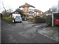
Homestead Park, Dollis Hill
This is a private road built in 1926 of Arts and Crafts designed blocks.
Image: © David Howard
Taken: 22 Jan 2014
0.07 miles
5
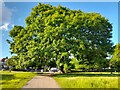
Tree in Path into Gladstone Park, Cricklewood
Image: © David Howard
Taken: 1 Jun 2022
0.09 miles
7
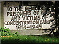
Plaque on holocaust memorial, Gladstone Park
Plaque ‘to the memory of prisoners of war and victims of concentration camps 1914–1945’ with sculpture by Fred Kormis in Gladstone Park, see Image
Image: © David Hawgood
Taken: 15 Oct 2021
0.09 miles
8
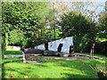
Memorial to prisoners of war and victims of concentration camps
This memorial sculpture group ‘to the memory of prisoners of war and victims of concentration camps 1914–1945’ by Fred Kormis is in Gladstone Park, Willesden. It is listed Grade II Historic England entry 1431369 https://historicengland.org.uk/listing/the-list/list-entry/1431369 , that website gives extensive details. See Image for plaque.
Image: © David Hawgood
Taken: 15 Oct 2021
0.09 miles
9
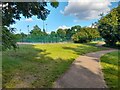
Gladstone Park, Cricklewood
They have 11 tennis courts which are all like new.
Image: © David Howard
Taken: 1 Jun 2022
0.10 miles
10
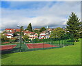
Tennis courts, Gladstone Hill Park
View across Dollis Hill Lane, tower of former Dollis Hill Post Office research building on the right.
Image: © David Hawgood
Taken: 15 Oct 2021
0.10 miles