IMAGES TAKEN NEAR TO
Cheviot Gardens, LONDON, NW2 1QH
Introduction
This page details the photographs taken nearby to Cheviot Gardens, NW2 1QH by members of the Geograph project.
The Geograph project started in 2005 with the aim of publishing, organising and preserving representative images for every square kilometre of Great Britain, Ireland and the Isle of Man.

There are currently over 7.5m images from over14,400 individuals and you can help contribute to the project by visiting https://www.geograph.org.uk
Image Map
Images are licensed for reuse under creativecommons.org/licenses/by-sa/2.0
Notes
- Clicking on the map will re-center to the selected point.
- The higher the marker number, the further away the image location is from the centre of the postcode.
Image Listing (34 Images Found)
Images are licensed for reuse under creativecommons.org/licenses/by-sa/2.0
Image
Details
Distance
1
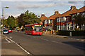
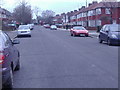
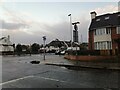
Pennine Drive
Pennine Drive, as befits its name, forms the backbone of this 1930's housing estate around which concentric side roads form an oval pattern. The side roads are all named after ranges of hills and areas adjoining the Pennines. This is the junction with Cleveland Gardens on the left and Cumbrian Gardens on the right.
First DML44087 on the 226 route catches the evening sun as it waits for a 102 going in the other direction.
Image: © Martin Addison
Taken: 10 Oct 2009
0.07 miles
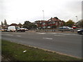
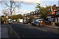
3
Pennine Drive, Cricklewood
This housing estate is noticeable on the map as the layout has two concentric ellipses and a central spine, which is Pennine Drive. Other streets also have hilly names - Cheviot, Cumbrian, Cotswold, Chiltern, Cleveland, Quantock and Grampian Gardens, Purbeck Drive.
Image: © David Hawgood
Taken: 15 Oct 2005
0.09 miles
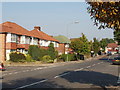
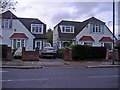
4
The Vale, Cricklewood
At junction of Hendon Way
Image: © David Howard
Taken: 20 Jan 2011
0.09 miles
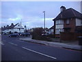
6
Pennine Drive
Shops with housing above in the centre of the 1930's housing estate. Pennine Drive, as befits its name, forms the backbone of the estate around which concentric side roads form an oval pattern. The side roads are all named after ranges of hills.
Image: © Martin Addison
Taken: 10 Oct 2009
0.10 miles
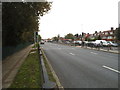
9
The Vale at the junction of Hendon Way
Image: © David Howard
Taken: 28 Oct 2020
0.10 miles
10
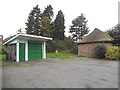
The cafe and shelter in Basing Hill Park
The cafe is very reasonable and good quality. They do put out tables during the season but don't know if it's open all year.
Image: © David Howard
Taken: 24 Oct 2014
0.11 miles