
IMAGES TAKEN NEAR TO
Hill Avenue, GREAT YARMOUTH, NR31 6HP
Introduction
This page details the photographs taken nearby to Hill Avenue, NR31 6HP by members of the Geograph project.
The Geograph project started in 2005 with the aim of publishing, organising and preserving representative images for every square kilometre of Great Britain, Ireland and the Isle of Man.

There are currently over 7.5m images from over14,400 individuals and you can help contribute to the project by visiting https://www.geograph.org.uk
Image Map
Images are licensed for reuse under creativecommons.org/licenses/by-sa/2.0
Notes
- Clicking on the map will re-center to the selected point.
- The higher the marker number, the further away the image location is from the centre of the postcode.
Image Listing (37 Images Found)
Images are licensed for reuse under creativecommons.org/licenses/by-sa/2.0
Image
Details
Distance
1

Former railway embankment
The embankment would have closely followed the line of the trees. As the ground rises the height of the embankment would have reduced to continue beneath the bridge on Bridge Road (extreme left).
Image: © Adrian S Pye
Taken: 27 Oct 2022
0.07 miles
2
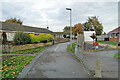
The site of the Gorleston Links Halt
The halt was at the top of the embankment with steps leading down to ground level. Constructed and opened in 1914, for access to the golf club and course it was suspended 4 years later and a post war economy measure but reinstated shortly after as a result of the increasing number of holiday makers visiting the area.
The area where the halt was situated has changed greatly in the years since its closure in 1970. Residential redevelopment led to the removal of the bridge and embankment, leaving no trace of the former halt.
A halt was not a station with facilities, but a platform for passengers to board and alight by request.
Image: © Adrian S Pye
Taken: 27 Oct 2022
0.10 miles
3
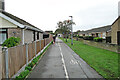
Looking towards the Links Halt from Newton Cross
The 16 foot (5 metre) high embankment is gone but this path follows the route to Gorleston Halt.
Image: © Adrian S Pye
Taken: 27 Oct 2022
0.10 miles
4
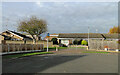
The site of Links Halt, Gorleston
The track and the Halt was on an 16 feet (5 metre) high embankment with steps down to ground level, giving the name to the street from where this image is taken. Many are confused by the name Hill Avenue, when the landscape in the area is now so flat.
Image: © Adrian S Pye
Taken: 10 Nov 2022
0.10 miles
5

Bus stop on Yallop Avenue, Gorleston-on-Sea
Image: © JThomas
Taken: 28 Apr 2016
0.10 miles
6

Yallop Avenue, Gorleston-on-Sea
Heading west.
Image: © JThomas
Taken: 28 Apr 2016
0.13 miles
7

Junction of Links Road and Yallop Avenue
Image: © Helen Steed
Taken: 13 Nov 2012
0.14 miles
8
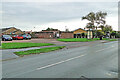
The gas governor marks the route of the former railway
The bricked-in gas governor would have been buried beneath the embankment had it been there at the time.
The bridge, which was a plate girder construction, spanned Links Road on an embankment which extended to Gorleston Links Halt, 100 yards north of here and beyond. The Halt stood at the southwest end of what is now Hill Avenue, named after the fact there was once an embankment creating the hill.
Needless to say all traces of the embankment were removed for the housing development.
Image: © Adrian S Pye
Taken: 27 Oct 2022
0.15 miles

10

Warren Road, Gorleston-on-Sea
At the junction with Links Road
Image: © Geographer
Taken: 5 Mar 2013
0.17 miles