1
Old Milestone by the A40, Beaufort Street, Crickhowell
Stone post in wall by the A40, in parish of Crickhowell (Powys District), Beaufort Street, Crickhowell. In front of Health Centre, inset into wall, Southeast of war memorial.
Inscription reads:-
BRECON
14
Surveyed
Milestone Society National ID: BRE_BCAG14
Image: © Milestone Society
Taken: Unknown
0.02 miles
2
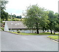
East side of Castle Park, Crickhowell
Between Castle Road on this side and the A40 Beaufort Street.
Image: © Jaggery
Taken: 19 Dec 2014
0.02 miles
3
Bench and grit box, Castle Road, Crickhowell
Near the A40 junction. The sign on the wall shows CASTLE ROAD 11-20.
Image: © Jaggery
Taken: 19 Dec 2014
0.02 miles
4
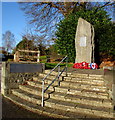
Crickhowell War Memorial
Steps lead up to the War Memorial at the edge of the A40 Beaufort Street. The 3 metre (10 feet) high granite stone is near the site of the demolished Crickhowell War Memorial Hospital.
Image: © Jaggery
Taken: 19 Dec 2014
0.02 miles
5
Crickhowell War Memorial
On Beaufort Street.
Image: © Andrew Abbott
Taken: 14 Mar 2020
0.02 miles
6
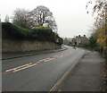
Towards a bend in the A40, Crickhowell
Ahead for Abergavenny. Behind the camera for Crickhowell town centre.
Image: © Jaggery
Taken: 29 Nov 2020
0.02 miles
7
War Memorial Health Centre, Crickhowell
Set back from Beaufort Street (A40), a few tens of metres from the War Memorial. http://www.geograph.org.uk/photo/2469372
The site was formerly occupied by Crickhowell War Memorial Hospital.
Image: © Jaggery
Taken: 19 Jun 2011
0.02 miles
8
Llangenny Lane, Crickhowell
Viewed from the corner of the A40. Signs warn of a 25% (1 in 4) gradient ahead, and state that the route is unsuitable for HGVs (Heavy Goods Vehicles).
Image: © Jaggery
Taken: 19 Jun 2011
0.04 miles
9
Racing into Crickhowell
Two racing cyclists on the A40 enter the SE edge of Crickhowell at speed.
The boundary sign shows that Crickhowell is twinned with Scaër, a commune in the Finistère department in Brittany, NW France.
Image: © Jaggery
Taken: 19 Jun 2011
0.04 miles
10
King George VI postbox in Crickhowell
In a Llangenny Lane wall near the A40 junction. In December 2014,
last collection time is shown as 7am on Saturdays and 9am on Mondays-Fridays,
when a 4pm or later collection is made from the postbox at Crickhowell
post office http://www.geograph.org.uk/photo/4283249 and at 6pm from St Johns Square, Abergavenny.
Image: © Jaggery
Taken: 19 Dec 2014
0.04 miles


