IMAGES TAKEN NEAR TO
Jasmine Close, NOTTINGHAM, NG9 3LH
Introduction
This page details the photographs taken nearby to Jasmine Close, NG9 3LH by members of the Geograph project.
The Geograph project started in 2005 with the aim of publishing, organising and preserving representative images for every square kilometre of Great Britain, Ireland and the Isle of Man.

There are currently over 7.5m images from over14,400 individuals and you can help contribute to the project by visiting https://www.geograph.org.uk
Image Map
Images are licensed for reuse under creativecommons.org/licenses/by-sa/2.0
Notes
- Clicking on the map will re-center to the selected point.
- The higher the marker number, the further away the image location is from the centre of the postcode.
Image Listing (36 Images Found)
Images are licensed for reuse under creativecommons.org/licenses/by-sa/2.0
Image
Details
Distance
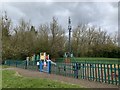
2
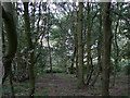
On Bramcote Hills
Part of the Alexandrina Plantation Nature Reserve. This is still a remarkably unspoilt area in the middle of suburban housing development, with natural vegetation. It lies on the sandstone outcrop of Bramcote Hills, and the sandy nature of the soil is shown by some typical vegetation - broom and birch. The sandy soil is clear too from the footpath.
Image: © Alan Murray-Rust
Taken: 6 Sep 2009
0.09 miles
3
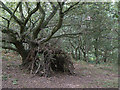
Tree House
In the Alexandrina Plantation on Bramcote Hill. The woodland cover consists principally of oak and birch.
Image: © Alan Murray-Rust
Taken: 6 Sep 2009
0.09 miles
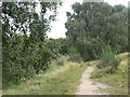
4
Track on Bramcote Hills
Looking north.
Image: © Andrew Abbott
Taken: 29 Mar 2020
0.09 miles
5
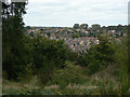
View from Bramcote Hills
Looking over Wollaton Vale, a large area of suburban development dating from the 1930s to the 1960s.
Image: © Alan Murray-Rust
Taken: 6 Sep 2009
0.15 miles
6
Alexandrina Plantation
On the north scarp of Bramcote Hills, a sandstone outcrop which has avoided being built over due to the steep slope here. The woodland cover consists principally of oak and birch.
Image: © Alan Murray-Rust
Taken: 6 Sep 2009
0.16 miles
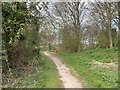
7
Robin Hood Way
Link footpath out of Kingsdown Mount onto Bramcote Hills. Although marked on the OS maps, this section of the route is not waymarked or signposted and is difficult to follow even from the 1:25000 map.
Image: © Alan Murray-Rust
Taken: 6 Sep 2009
0.16 miles
8
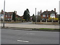
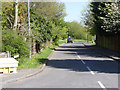
Carwood Road
Looking across the Derby Road [A52] from the Nurseryman pub.
Image: © M J Richardson
Taken: 3 Mar 2011
0.18 miles
9
David Grove, Beeston
Seen from its junction with Derby Road.
Image: © Richard Vince
Taken: 7 Jul 2012
0.19 miles
10
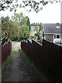
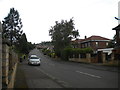
Markham Road, Bramcote Hills
Access to housing to the east of Sandy Lane developed during the late 1970s.
Image: © Alan Murray-Rust
Taken: 16 Apr 2014
0.19 miles