
IMAGES TAKEN NEAR TO
Fretwell Street, NOTTINGHAM, NG7 5JL
Introduction
This page details the photographs taken nearby to Fretwell Street, NG7 5JL by members of the Geograph project.
The Geograph project started in 2005 with the aim of publishing, organising and preserving representative images for every square kilometre of Great Britain, Ireland and the Isle of Man.

There are currently over 7.5m images from over14,400 individuals and you can help contribute to the project by visiting https://www.geograph.org.uk
Image Map
Images are licensed for reuse under creativecommons.org/licenses/by-sa/2.0
Notes
- Clicking on the map will re-center to the selected point.
- The higher the marker number, the further away the image location is from the centre of the postcode.
Image Listing (239 Images Found)
Images are licensed for reuse under creativecommons.org/licenses/by-sa/2.0
Image
Details
Distance
1
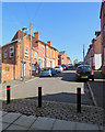
Up Grundy Street
Until the 1930s these terraced streets were near the western edge of Nottingham.
Image: © John Sutton
Taken: 5 May 2018
0.02 miles
2
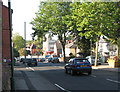
Bobbers Mill Road and the Cappo
The steep Alfreton Road end of Bobbers Mill Road, with the former Capitol Cinema ("The Cappo"), now a gospel church, on the corner of Churchfield Lane and Newquay Avenue.
Image: © John Sutton
Taken: 24 Sep 2009
0.02 miles
3
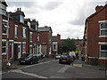
Grundy Street
From the corner of Fretwell Street. Until new residential streets were built to the west of Bobbers Mill Road and Churchfield Lane in the late 1930s, these streets were on the edge of Radford.
Image: © John Sutton
Taken: 12 Jul 2011
0.03 miles
4
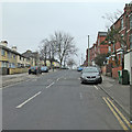
Up Bobbers Mill Road on an overcast morning
Like Churchfield Lane (behind the camera) Bobbers Mill Road marks a boundary between Victorian and Edwardian Nottingham and the huge westward expansion of the city's suburbs which began in the 1930s and continued in the years after the War.
Image: © John Sutton
Taken: 11 Apr 2013
0.03 miles
5
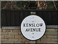
Kenslow Avenue
These distinctive circular street signs were once standard issue for Nottingham's streets and estates of municipal housing.
Image: © John Sutton
Taken: 24 Sep 2009
0.03 miles
6

Benchmark on #225 Bobbers Mill Road
Ordnance Survey cut mark benchmark described on the Bench Mark Database at http://www.bench-marks.org.uk/bm47876
Image: © Roger Templeman
Taken: 31 Mar 2013
0.04 miles
7
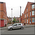
Southport Terrace
Houses off Berridge Road West, opposite Berridge Primary School. House backs on Grundy Street show beyond.
Image: © John Sutton
Taken: 29 Aug 2017
0.04 miles
8
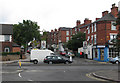
Up Bobbers Mill Road
The traffic going towards town is on Alfreton Road. The road works shown incomplete in Image] mean it is no longer possible to cross from Churchfield Lane (behind the camera) to Bobbers Mill Road (straight ahead).
Image: © John Sutton
Taken: 12 Jul 2011
0.04 miles
10
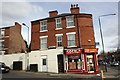
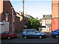
Junction of Bobbers Mill Road and Alfreton Road (A610)
#225 Bobbers Mill Road, PAPU's Fish and Chip shop, has an OS benchmark Image in its white bricks
Image: © Roger Templeman
Taken: 31 Mar 2013
0.04 miles