
IMAGES TAKEN NEAR TO
Mansfield Street, NOTTINGHAM, NG5 4AU
Introduction
This page details the photographs taken nearby to Mansfield Street, NG5 4AU by members of the Geograph project.
The Geograph project started in 2005 with the aim of publishing, organising and preserving representative images for every square kilometre of Great Britain, Ireland and the Isle of Man.

There are currently over 7.5m images from over14,400 individuals and you can help contribute to the project by visiting https://www.geograph.org.uk
Image Map
Images are licensed for reuse under creativecommons.org/licenses/by-sa/2.0
Notes
- Clicking on the map will re-center to the selected point.
- The higher the marker number, the further away the image location is from the centre of the postcode.
Image Listing (90 Images Found)
Images are licensed for reuse under creativecommons.org/licenses/by-sa/2.0
Image
Details
Distance
1
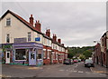
Sherwood, NG5, Nottingham.
Hall Street from the intersection with Mansfield Street. Mansfield Road (the A60) lies behind 30 seconds walk away behind the photographer.
Image: © David Hallam-Jones
Taken: 13 Jun 2013
0.03 miles
2
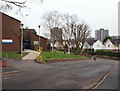
Nottingham, NG5 - Sherwood
With the initial section of Elmswood Gardens and Mansfield Road (A60) both behind the photographer, this is a view of the middle section of Elmswood Gardens with Sherwood Health Centre on the left and the two tower blocks - "Woodthorpe Court" and "Winchester Court" situated on Chestnut Walk, in the distance.
Image: © David Hallam-Jones
Taken: 24 Nov 2012
0.04 miles
3
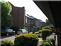
The Firs
The Firs is now a care home for the elderly, but was previously a maternity hospital. The day the 1948 London Olympics opened was blazingly hot, something my mother never forgot as I was born somewhere in the building straight ahead on that day. The eaves of one of the more recently-built parts of The Firs take up the top right quarter of the picture, unfortunately, but also made it possible to take an east-pointing picture early on a bright May morning.
Image: © John Sutton
Taken: 18 May 2010
0.05 miles
4
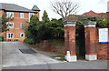
Nottingham, NG5 - Sherwood
With Mansfield Road (the A60) to the left of the photographer, this is a view through the former maternity hospital's entrance into the grounds of what is now an Abbeyfield (Nottingham) Society retirement complex known as "The Firs". This offers independent living accommodation, warden supervised accommodation and a nursing home all on one site. A house was first built on this plot in 1895 by Mr Alfred Manchester, a Nottingham tea merchant, as his private residence although between 1925-82 it was firstly, a private maternity home and latterly a NHS maternity unit.
Image: © David Hallam-Jones
Taken: 24 Nov 2012
0.05 miles
5
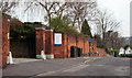
Nottingham, NG5 - Sherwood
With Mansfield Road (the A60) behind the photographer, this is a view along Elmswood Gardens in the direction of Applewood Grove and The Rise. Behind the high brick wall lies an Abbeyfield (Nottingham) Society complex known as "The Firs". This now offers independent living accommodation, warden supervised accommodation and a nursing home all on one site. A house was first built on this plot in 1895 by Mr Alfred Manchester, a Nottingham tea merchant, as his private residence although between 1925-82 it was firstly, a private maternity home and then a NHS maternity unit. One of the two tower blocks in Chestnut Walk is visible in the distance.
Image: © David Hallam-Jones
Taken: 24 Nov 2012
0.05 miles
6
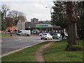
Nottingham - NG5
A view of the junction of Edwards Lane, Sherwood at the point where it meets Mansfield Rd (A60). The Co-Op supermarket was previously a branch of Somerfield Stores Ltd. The Somerfield brand bought out the former Gateway supermarket chain in the 1990s but then the Somerfield chain was replaced by the Co-operative brand in a programme of store conversions that ended in Spring 2011. Behind the brick wall to the left are a range of retirement flats and bungalows on the site of the former Firs Maternity Hospital.
Image: © David Hallam-Jones
Taken: 21 Mar 2012
0.07 miles
7
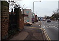
Nottingham, NG5 - Sherwood
In 1895 Alfred Manchester, a Nottingham tea merchant, built a private residence behind these now-defunct gates on Mansfield Road (a.k.a. the A60). Between 1926-86, "The Firs Maternity Home", and later on "The Firs NHS Maternity Unit", was developed on the site with an entrance in Elmswood Gardens - i.e. the road that the brown car is coming out of. Some of the newer houses in Hooley Street were actually built upon the tea merchant's kitchen garden around the corner, the land having been bought by developers during the 20th century. Thereafter, the street was renamed Elmswood Gardens. An Abbeyfield Society Retirement Complex is now situated behind these gates, albeit that its entrance is in this neighbouring street. Directly ahead is a section of Sherwood's main shopping promenade known locally as "Sherwood Shops", with Nottingham City Centre being 10 mins journey further on (by car).
Image: © David Hallam-Jones
Taken: 24 Nov 2012
0.07 miles
8
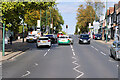
Mansfield Road, Sherwood
The A60 in the Sherwood district of Nottingham.
Image: © David Dixon
Taken: 13 Oct 2022
0.07 miles
9
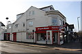
No. 664 Mansfield Road (Bargain Booze) at Hall Street junction
Ordnance Survey documents indicate that in 1962 a cut mark benchmark was levelled at 73.673m above Newlyn Datum on the building beside the Hall Street street name sign. The mark has been covered by render.
Image: © Luke Shaw
Taken: 1 Apr 2019
0.08 miles
10
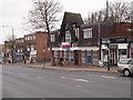
Nottingham - Sherwood NG5
A view of Mansfield Rd (A60) looking in the direction of Nottingham city centre. The now defunct police station at No.621 Mansfield Road can be seen on the right, with the junction with Burlington Road beyond it. This station opened in October 2007 to provide a more visible local police presence. It was closed in 2011 as part of an economy drive although plans have been approved for the opening of a part-time mini-police station beneath Sherwood Library in 2012-13.
Image: © David Hallam-Jones
Taken: 16 Mar 2012
0.08 miles