Nottingham - NG5
Introduction
The photograph on this page of Nottingham - NG5 by David Hallam-Jones as part of the Geograph project.
The Geograph project started in 2005 with the aim of publishing, organising and preserving representative images for every square kilometre of Great Britain, Ireland and the Isle of Man.

There are currently over 7.5m images from over 14,400 individuals and you can help contribute to the project by visiting https://www.geograph.org.uk
Nottingham - NG5
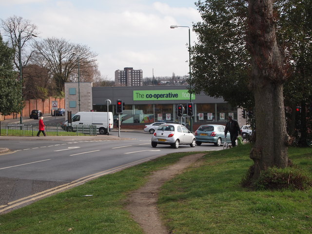
Image: © David Hallam-Jones Taken: 21 Mar 2012
A view of the junction of Edwards Lane, Sherwood at the point where it meets Mansfield Rd (A60). The Co-Op supermarket was previously a branch of Somerfield Stores Ltd. The Somerfield brand bought out the former Gateway supermarket chain in the 1990s but then the Somerfield chain was replaced by the Co-operative brand in a programme of store conversions that ended in Spring 2011. Behind the brick wall to the left are a range of retirement flats and bungalows on the site of the former Firs Maternity Hospital.
Images are licensed for reuse under creativecommons.org/licenses/by-sa/2.0
Image Location
Latitude
52.983959
Longitude
-1.14424