Nottingham, NG5 - Sherwood
Introduction
The photograph on this page of Nottingham, NG5 - Sherwood by David Hallam-Jones as part of the Geograph project.
The Geograph project started in 2005 with the aim of publishing, organising and preserving representative images for every square kilometre of Great Britain, Ireland and the Isle of Man.

There are currently over 7.5m images from over 14,400 individuals and you can help contribute to the project by visiting https://www.geograph.org.uk
Nottingham, NG5 - Sherwood
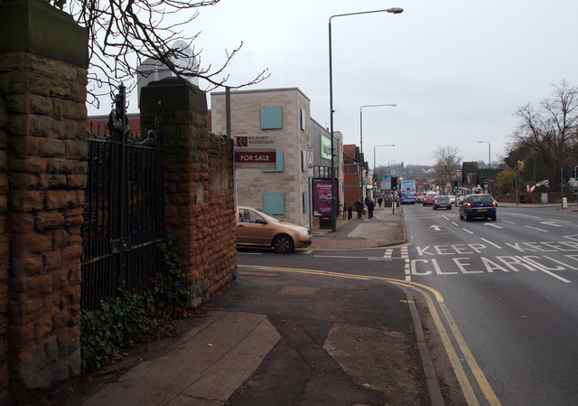
Image: © David Hallam-Jones Taken: 24 Nov 2012
In 1895 Alfred Manchester, a Nottingham tea merchant, built a private residence behind these now-defunct gates on Mansfield Road (a.k.a. the A60). Between 1926-86, "The Firs Maternity Home", and later on "The Firs NHS Maternity Unit", was developed on the site with an entrance in Elmswood Gardens - i.e. the road that the brown car is coming out of. Some of the newer houses in Hooley Street were actually built upon the tea merchant's kitchen garden around the corner, the land having been bought by developers during the 20th century. Thereafter, the street was renamed Elmswood Gardens. An Abbeyfield Society Retirement Complex is now situated behind these gates, albeit that its entrance is in this neighbouring street. Directly ahead is a section of Sherwood's main shopping promenade known locally as "Sherwood Shops", with Nottingham City Centre being 10 mins journey further on (by car).
Images are licensed for reuse under creativecommons.org/licenses/by-sa/2.0
Image Location
Latitude
52.984137
Longitude
-1.143939