1
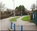
Central Avenue, Mapperley Plains, Notts.
With Plains Road, i.e. the B684 (Nottingham to Dorket Head road) 150 metres behind the photographer, this is a cul-de-sac that providing access to Mapperley Golf Club and the Mapperley Plains Junior School only. Behind the waist-high, black-painted bollard however, a combined footpath and bridleway drops away - downhill - towards Mapperley Recreation Ground.
Image: © David Hallam-Jones
Taken: 1 Jan 2016
0.01 miles
2
Central Avenue, Mapperley Plains, Notts.
Ahead is the approach road leading to Mapperley Golf Club (500 metres ahead) and on the left is Mapperley Plains Primary School.
Image: © David Hallam-Jones
Taken: 1 Jan 2016
0.01 miles
3
Central Avenue, Mapperley Plains, Notts.
This is the view that someone leaving either Mapperley Golf Club or Mapperley Plains Junior School would see as they approach Plains Road, i.e. the B684 (Nottingham to Dorket Head road) 150 metres ahead (round the right hand bend). Behind the photographer Central Avenue is a dead end from in front of the Golf Club's clubhouse. This photo was taken from the school's main gates. On the left, just behind the middle lamp post is a combined footpath and bridleway that drops away - downhill - towards Mapperley Recreation Ground.
Image: © David Hallam-Jones
Taken: 1 Jan 2016
0.02 miles
4
Central Avenue Vicinity, Mapperley Plains, Notts.
The view of the start (or end) of a footpath/bridleway, seen from obliquely opposite the gates of Mapperley Plains Junior School. This combined footpath/bridleway continues downhill in the direction of Mapperley Recreation Ground.
Image: © David Hallam-Jones
Taken: 1 Jan 2016
0.02 miles
5
Bus turn round
At least that is what used to occupy this little patch of open space. Changes to the bus network as travel patterns have changed resulted in it being abandoned as a terminus some years ago and the tarmac has been replaced with grass.
Image: © Alan Murray-Rust
Taken: 1 Feb 2009
0.05 miles
6
Golf Course, Mapperley Plains, Notts.
A view across part of Mapperley Golf Course. The houses in the distance seem likely to be properties on Hazel Grove and/or Digby Avenue.
Image: © David Hallam-Jones
Taken: 1 Jan 2016
0.05 miles
7
Site of Central Avenue turning circle, Mapperley
On Plains Road opposite the top of Somersby Road. In the 1970s, half of Nottingham City Transport's Mapperley service terminated here, with the other half running to and from Gedling via Westdale Lane. By the mid 1990s, NCT's remaining buses to this part of Mapperley had been extended along Somersby Road (behind the camera) towards Arno Vale, Plains Estate, and Arnold. Some years ago, the turning circle was turned into the present small patch of grass.
Image: © Richard Vince
Taken: 17 Apr 2014
0.07 miles
8
Apartments, Plains Road, Nottingham
Image: © JThomas
Taken: 1 Jul 2010
0.07 miles
9
Mapperley Plains: Gedling Miners' Welfare football ground
Gedling MW FC plays in the East Midlands Counties League. The colliery, which closed in the 1990s, was 200ft or so below here, in the valley to the south-east of Mapperley Plains.
Image: © John Sutton
Taken: 23 Jun 2014
0.09 miles
10
Somersby Road, Nottingham
Image: © JThomas
Taken: 1 Jul 2010
0.09 miles


