1
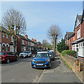
Benchmark on the wall in front of #4 Burleigh Road
Ordnance Survey cut mark benchmark, partly hidden behind cable guard, levelled at 28.164m above Newlyn Datum with more information on the Bench Mark Database at www.bench-marks.org.uk/bm112891
Image: © Roger Templeman
Taken: 14 May 2018
0.02 miles
2
#4 Burleigh Road
There is an OS benchmark
Image on the fronting wall between the metal gates and the lamppost, partly behind the cable guard
Image: © Roger Templeman
Taken: 14 May 2018
0.02 miles
3
West Bridgford: along Gordon Road
Because of road works and temporary re-routing of the No 6 service from Edwalton this bus stop was out of use.
Image: © John Sutton
Taken: 3 Jul 2019
0.07 miles
4
West Bridgford Junior School, Exchange Road
The school was formerly known as South County Junior.
Image: © John Sutton
Taken: 3 Jul 2019
0.07 miles
5
West Bridgford: Trevor Road closed
Road works caused a temporary re-routing of No 6 buses to and from Edwalton.
Image: © John Sutton
Taken: 3 Jul 2019
0.08 miles
6
West Bridgford: Stanley Road
A cul-de-sac of fairly typical Bridgford villas, off Carnarvon Road, photographed on a cloudy July morning.
Image: © John Sutton
Taken: 6 Jul 2021
0.09 miles
7
West Bridgford Junior School, at Exchange Road / Carnarvon Road junction
There is an OS benchmark
Image on the Exchange Road (left hand) side of the wall corner, level with the no through road sign
Image: © Roger Templeman
Taken: 14 May 2018
0.09 miles
8
Benchmark on Exchange Road wall outside West Bridgford Junior School
Ordnance Survey cut mark benchmark levelled at 25.887m above Newlyn Datum with additional information to be found on the Bench Mark Database at www.bench-marks.org.uk/bm112892
Image: © Roger Templeman
Taken: 14 May 2018
0.10 miles
9
West Bridgford: Carnarvon Road
Looking towards Melton Road on the morning of Easter Sunday. This was one of many roads laid out as Bridgford expanded from village to populous suburb in the last years of the 19th century and the first decade of the twentieth - and in those days the anglicised spelling of Caernarfon was the accepted one.
Image: © John Sutton
Taken: 17 Apr 2022
0.12 miles
10
West Bridgford: along Carnarvon Road
These villas are a little grander than those in the next street, where my grandparents lived. Anglicised spelling of Welsh place names was usual when these houses were built.
Image: © John Sutton
Taken: 6 Jul 2021
0.13 miles


