
IMAGES TAKEN NEAR TO
Sneinton Hermitage, NOTTINGHAM, NG2 4BT
Introduction
This page details the photographs taken nearby to Sneinton Hermitage, NG2 4BT by members of the Geograph project.
The Geograph project started in 2005 with the aim of publishing, organising and preserving representative images for every square kilometre of Great Britain, Ireland and the Isle of Man.

There are currently over 7.5m images from over14,400 individuals and you can help contribute to the project by visiting https://www.geograph.org.uk
Image Map
Images are licensed for reuse under creativecommons.org/licenses/by-sa/2.0
Notes
- Clicking on the map will re-center to the selected point.
- The higher the marker number, the further away the image location is from the centre of the postcode.
Image Listing (288 Images Found)
Images are licensed for reuse under creativecommons.org/licenses/by-sa/2.0
Image
Details
Distance
1
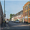
Sneinton Hermitage
A view towards the city from the corner of Meadow Lane. Years ago this was a trolleybus route, and the vista was closed by the huge railway bridge which carried the tracks to Manvers Street Goods Depot - its blue-brick abutment shows to the left of the row of houses on the right. The construction of that piece of railway destroyed the sandstone caves of Sneinton Hermitage which gave this road its name.
Image: © John Sutton
Taken: 4 Sep 2013
0.01 miles
2
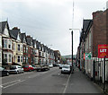
Sneinton Hermitage
Looking towards the junction of Sneinton Boulevard, Colwick Road and Meadow Lane. Image] is a view from the end of Meadow Lane on a brighter morning in September 2013.
Image: © John Sutton
Taken: 28 Apr 2014
0.02 miles
3
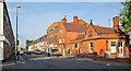
Sneinton Hermitage: street cleaning
A view from the corner of Colwick Road and Meadow Lane, with the former police station on the right.
Image: © John Sutton
Taken: 4 Sep 2013
0.03 miles
4
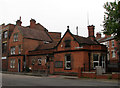
Sneinton: former Police Station
The current station is on Sneinton Dale. The borough coat of arms is on the gable (this building was built before Nottingham became a city in 1897).
Image: © John Sutton
Taken: 8 Sep 2010
0.03 miles
5
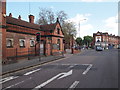
Nottingham - NG3 (Old Sneinton)
This former police station on Sneinton Hermitage (< road name) opened in 1894. At the junction ahead, the right hand branch becomes Colwick Road and the road to the left of the shop becomes Sneinton Boulevard.
Image: © David Hallam-Jones
Taken: 12 May 2012
0.03 miles
6
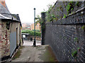
Sneinton: looking down Lees Hill Footway
These steps connect Lees Hill Street (up the hill) and Sneinton Hermitage. The blue-brick retaining wall on the right was part of the large London & North Western Railway goods yard. A bridge carrying four tracks crossed Sneinton Hermitage straight ahead, but there is now no trace of it on the south side of the road, or of the embankment which carried the LNWR goods branch to Trent Lane Junction. The land has been levelled; the yellow-brick houses are on Marham Close, a development built partly where the LNWR lines were and partly (to the right) where the Great Northern coal yard and elevated line to Victoria Station via Weekday Cross once were.
Image: © John Sutton
Taken: 8 Sep 2010
0.04 miles
7
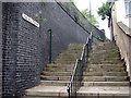
Sneinton: Lees Hill Footway
These steps connect Sneinton Hermitage (behind the camera) and Lees Hill Street. The blue-brick retaining wall on the left was part of the large London & North Western Railway Manvers Street goods yard, which was built into the side of the hill and approached by an embankment and a substantial four-track bridge over Sneinton Hermitage. The LNWR gained access to Nottingham through the alliance with the Great Northern which led to the building of the GN&LNW Joint Line through the Vale of Belvoir to Melton Mowbray, Market Harborough and Northampton. The LNWR goods warehouse at Manvers Street was badly damaged by the Luftwaffe in Nottingham's biggest air raids in May 1941. The goods yard site is now occupied by houses of Newark Crescent.
Image: © John Sutton
Taken: 8 Sep 2010
0.04 miles
8
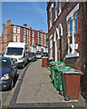
Sneinton: up St Stephen's Road
Sneinton expanded in the last twenty years of the nineteenth century. The gothic-arched paired doorways hereabouts all have male and female label stops: see Image] and Image
Image: © John Sutton
Taken: 16 May 2016
0.04 miles
9
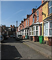
Sneinton: St Stephen's Avenue
Sneinton mushroomed after the parish became part of the Borough of Nottingham in 1877.
Image: © John Sutton
Taken: 16 May 2016
0.04 miles
10
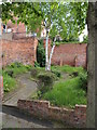
Nottingham - NG3 (Old Sneinton)
A small off-shot public garden at the mid-point along Lee's Hill Footway - connecting Sneinton Hermitage (i.e. the road of this name) and Lees Hill Street - shows determination on someone's part to make this shortcut a little more acceptable to the local inhabitants.
Image: © David Hallam-Jones
Taken: 12 May 2012
0.04 miles