Sneinton: looking down Lees Hill Footway
Introduction
The photograph on this page of Sneinton: looking down Lees Hill Footway by John Sutton as part of the Geograph project.
The Geograph project started in 2005 with the aim of publishing, organising and preserving representative images for every square kilometre of Great Britain, Ireland and the Isle of Man.

There are currently over 7.5m images from over 14,400 individuals and you can help contribute to the project by visiting https://www.geograph.org.uk
Sneinton: looking down Lees Hill Footway
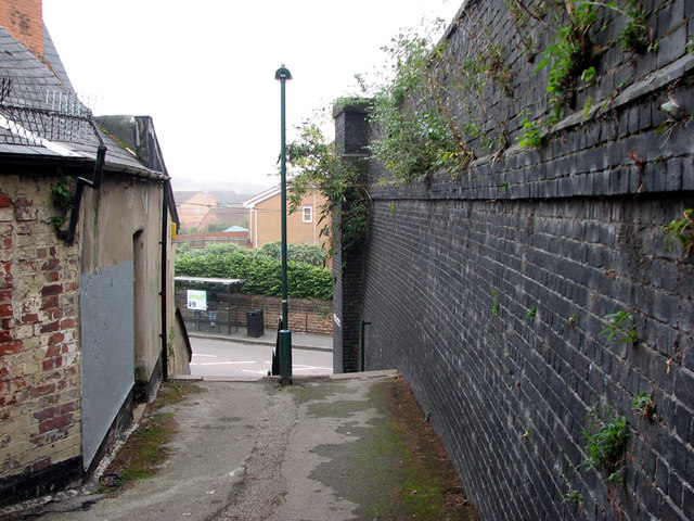
Image: © John Sutton Taken: 8 Sep 2010
These steps connect Lees Hill Street (up the hill) and Sneinton Hermitage. The blue-brick retaining wall on the right was part of the large London & North Western Railway goods yard. A bridge carrying four tracks crossed Sneinton Hermitage straight ahead, but there is now no trace of it on the south side of the road, or of the embankment which carried the LNWR goods branch to Trent Lane Junction. The land has been levelled; the yellow-brick houses are on Marham Close, a development built partly where the LNWR lines were and partly (to the right) where the Great Northern coal yard and elevated line to Victoria Station via Weekday Cross once were.
Images are licensed for reuse under creativecommons.org/licenses/by-sa/2.0
Image Location
Latitude
52.94916
Longitude
-1.13049