1
Mansfield, Notts.
With Nottingham Road (the A60) almost immediately behind the photographer, these are the pétanque pistes in Titchfield Park. The land was once a water meadow - perhaps prone to flooding by the River Maun - that was owned by the Duke of Portland. He leased it to the local Board of Improvement Commissioners in 1879, "in order that a recreational park for the public might be created". In 1914 it was renamed, from “Nottingham Road Pleasure Grounds” (a.k.a. The Water Meadows), to mark the coming of age of the Duke of Portland's son, the Marquis of Titchfield. This son was the eldest son of William Cavendish-Bentinck, the 4th Duke of Portland and his wife Henrietta, née Scott. The Marquis was elected to the House of Commons in 1819 as a Tory Member of Parliament for Bletchingley, although he lost that seat and became the M.P. for Kings Lynn in 1822. Unfortunately, he died in 1924 at the age of 27 yrs.
Image: © David Hallam-Jones
Taken: 13 Sep 2013
0.03 miles
2
Mansfield, Notts.
One of several bridges that crosses the ‘busy’ River Maun in Titchfield Park. In 1914 it was renamed, from “Nottingham Road Pleasure Grounds” (a.k.a. The Water Meadows), to mark the coming of age of the Duke of Portland's son, the Marquis of Titchfield. Opened in 1881, today the park offers ornamental gardens, playground areas, a multi-purpose games area, a pavilion, a performance area, pétanque pistes and a meadow area for informal recreation. The riverside walk forms part of the Maun Valley Trail.
Image: © David Hallam-Jones
Taken: 13 Sep 2013
0.05 miles
3
Mansfield, Notts.
St Mark's Church is seen here from inside to one of the Nottingham Road (A60) access points into and out of Titchfield Park. The building - in stone - by Temple Moore, was opened in 1897. It was built on the site of a temporary iron building that had succeeded the 'Navvy Mission' (for workers employed in building the railway line to Worksop), and which had served as the parish church of St Mark from 1889, when the parish was created.
The building consists of nave, side chapel and a small tower at the south east corner containing one bell by Mears & Stainbank, cast in 1892. The exterior is almost conventional neo-Perpendicular, plain but dignified.
Image: © David Hallam-Jones
Taken: 13 Sep 2013
0.05 miles
4
Petanque club, Titchfield Park, Mansfield
The club incorporates up to 15 international size pistes on the site of a former lawn bowls green.
Image: © Alan Murray-Rust
Taken: 21 Aug 2019
0.05 miles
5
Mansfield, Notts.
The 'busy' River Maun making its way through Titchfield Park, its two sides being linked by several bridges. This fairly extensive plot of land has been a recreational area since 1880. It was formerly known as Nottingham Road Pleasure Grounds or The Water Meadows. It was renamed Titchfield Park in 1914, to mark the coming of age of the Duke of Portland's son, Marquis of Titchfield. This green corridor forms part of the Maun Valley Trail. Nottingham Road (the A60) semi-encompasses the park, behind and to the left of this shot.
Image: © David Hallam-Jones
Taken: 13 Sep 2013
0.06 miles
6
Mansfield, Notts.
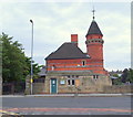
No longer occupied by "Lamb's" Michelin-starred restaurant, this building and the adjacent gates, seen from Sherwood Street, are both located on a corner of the plot of land that was previously home to the former cattle market. The grey roofed building behind it is part of "The Water Meadows Swimming Pool and Leisure Complex". The area takes its name from its former state and function beside the nearby River Maun. This imposing building, attributed to the well-known Nottingham-based architect, Fothergill Watson (a.k.a. Watson Fothergill), is officially known as Cattle Market House. Dating from 1877, it also housed "The Cattle Market Tavern" once. Its British Listed Buildings entry describes this elevation on Nottingham Road as having a projecting rock-faced stone ground floor with a round corner tower characterised by machicolated eaves and conical roof topped with a wind vane. Playground equipment in Titchfield Park is visible on the right.
Image: © David Hallam-Jones
Taken: 13 Sep 2013
0.06 miles
7
Titchfield Park, Mansfield
The River Maun has been canalised through the park. The modern 'Water Meadows' leisure complex indicates what the area would have been before urbanisation.
Image: © Alan Murray-Rust
Taken: 21 Aug 2019
0.07 miles
8
Mansfield, Notts
This red-brick building on Nottingham Road is attributed to the well-known Nottingham architect, Watson Fothergill and is described on the British Listed Buildings website as a "Former cattle market building and attached gates, dated 1877". A gardener working in the adjacent Titchfield Park described it as having once housed "The Cattle Market Tavern". Until 1877 the cattle market was originally held on Westgate, around the old market cross, after which this new purpose-built cattle market was opened. Although these premises still bear signs advertising it as the home of "Lamb's Restaurant", it is currently standing empty and unused. Behind this post-1877 market property is a plot of land that now houses the "Water Meadows Swimming Pool and Leisure Complex".
Image: © David Hallam-Jones
Taken: 13 Sep 2013
0.07 miles
9
Cattle Market weather vane
Image: © David Lally
Taken: 22 Mar 2010
0.07 miles
10
The former Cattle Market
Building by Watson Fothergill. This is the only surviving building of his in Mansfield, the town of his birth. It dates from 1877 and is grade II listed. Most of his work is in and around Nottingham.
The sign reading "Lambs" refers to the restaurant which now occupies the building.
Image: © David Lally
Taken: 22 Mar 2010
0.07 miles


