Mansfield, Notts.
Introduction
The photograph on this page of Mansfield, Notts. by David Hallam-Jones as part of the Geograph project.
The Geograph project started in 2005 with the aim of publishing, organising and preserving representative images for every square kilometre of Great Britain, Ireland and the Isle of Man.

There are currently over 7.5m images from over 14,400 individuals and you can help contribute to the project by visiting https://www.geograph.org.uk
Mansfield, Notts.
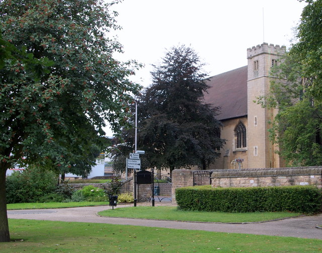
Image: © David Hallam-Jones Taken: 13 Sep 2013
St Mark's Church is seen here from inside to one of the Nottingham Road (A60) access points into and out of Titchfield Park. The building - in stone - by Temple Moore, was opened in 1897. It was built on the site of a temporary iron building that had succeeded the 'Navvy Mission' (for workers employed in building the railway line to Worksop), and which had served as the parish church of St Mark from 1889, when the parish was created. The building consists of nave, side chapel and a small tower at the south east corner containing one bell by Mears & Stainbank, cast in 1892. The exterior is almost conventional neo-Perpendicular, plain but dignified.
Images are licensed for reuse under creativecommons.org/licenses/by-sa/2.0
Image Location
Latitude
53.138404
Longitude
-1.196933