Mansfield, Notts.
Introduction
The photograph on this page of Mansfield, Notts. by David Hallam-Jones as part of the Geograph project.
The Geograph project started in 2005 with the aim of publishing, organising and preserving representative images for every square kilometre of Great Britain, Ireland and the Isle of Man.

There are currently over 7.5m images from over 14,400 individuals and you can help contribute to the project by visiting https://www.geograph.org.uk
Mansfield, Notts.
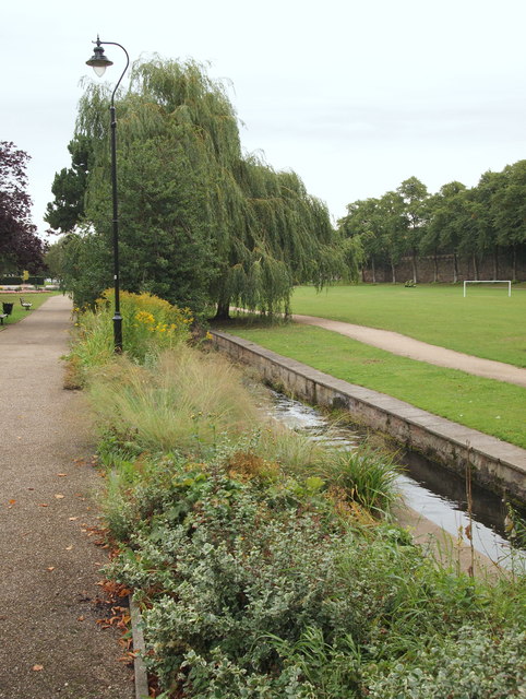
Image: © David Hallam-Jones Taken: 13 Sep 2013
The 'busy' River Maun making its way through Titchfield Park, its two sides being linked by several bridges. This fairly extensive plot of land has been a recreational area since 1880. It was formerly known as Nottingham Road Pleasure Grounds or The Water Meadows. It was renamed Titchfield Park in 1914, to mark the coming of age of the Duke of Portland's son, Marquis of Titchfield. This green corridor forms part of the Maun Valley Trail. Nottingham Road (the A60) semi-encompasses the park, behind and to the left of this shot.
Images are licensed for reuse under creativecommons.org/licenses/by-sa/2.0
Image Location
Latitude
53.138222
Longitude
-1.196638