
IMAGES TAKEN NEAR TO
Stephenson Road, NOTTINGHAM, NG16 3UD
Introduction
This page details the photographs taken nearby to Stephenson Road, NG16 3UD by members of the Geograph project.
The Geograph project started in 2005 with the aim of publishing, organising and preserving representative images for every square kilometre of Great Britain, Ireland and the Isle of Man.

There are currently over 7.5m images from over14,400 individuals and you can help contribute to the project by visiting https://www.geograph.org.uk
Image Map
Images are licensed for reuse under creativecommons.org/licenses/by-sa/2.0
Notes
- Clicking on the map will re-center to the selected point.
- The higher the marker number, the further away the image location is from the centre of the postcode.
Image Listing (49 Images Found)
Images are licensed for reuse under creativecommons.org/licenses/by-sa/2.0
Image
Details
Distance
1
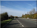
A610 View from Layby
The sign says 'Keep Broxtowe Tidy'.
Image: © Alan Heardman
Taken: 29 Oct 2008
0.07 miles
2
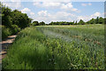
Nottingham Canal
This canal fell into disuse in the 1930s following the rise of rail transport. The success of the Erewash Canal, only about 100 yards to the west, also contributed to its demise. It is now a Nature Reserve managed by Broxtowe Borough Council, which stretches from Langley Mill on the Nottinghamshire/Derbyshire border to Wollaton in Nottingham.
Image: © Kate Jewell
Taken: 5 Jun 2008
0.10 miles
3
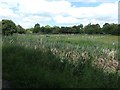
Paddocks on the north bank of the Nottingham Canal
The canal opened in 1796, fell out of use in the 1920s and was abandoned in 1937.
Image: © Christine Johnstone
Taken: 21 Jun 2019
0.10 miles
4
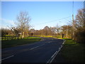
Newmanleys Road (South) south of Eastwood
Newmanleys Road was severed by the A610 Kimberley Eastwood Bypass; this section, which now appears totally unrelated to the rest of the road, acquired the bracketed suffix as a result. Newmanleys Road is less than 100 yards from here as the crow flies, but around half a mile away by road.
Image: © Richard Vince
Taken: 13 Dec 2014
0.13 miles
5
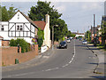
Brookhill Leys Road
This area was originally a separate community from Eastwood, known as New Eastwood, becoming joined together in the inter-war period with housing expansion.
Image: © Alan Murray-Rust
Taken: 13 Jul 2013
0.13 miles
6
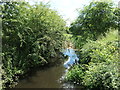
Nottingham Canal, east from Newmanleys Road swingbridge
The canal opened in 1796, fell out of use in the 1920s and was abandoned in 1937.
Image: © Christine Johnstone
Taken: 21 Jun 2019
0.13 miles
7
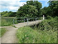
Newmanleys Road swingbridge, Nottingham Canal
Carrying a public footpath from New Eastwood, across the Nottingham Canal down to the Erewash Canal. What a survivor! The canal opened in 1796, fell out of use in the 1920s and was abandoned in 1937.
Image: © Christine Johnstone
Taken: 21 Jun 2019
0.13 miles
8
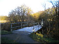
Frosty swing bridge over the Nottingham Canal
This swing bridge carries a public footpath across the derelict canal. The railings appear to be a fairly modern addition.
Image: © Richard Vince
Taken: 13 Dec 2014
0.14 miles
9
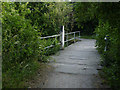
Swing bridge on the Nottingham Canal
The bridge survives as part of a public footpath and has been restored in recent years as part of Broxtowe Borough Council's programme of creating a linear nature reserve on the surviving parts of the canal. The Nottingham Canal was formally abandoned in 1938.
Image: © Alan Murray-Rust
Taken: 13 Jul 2013
0.14 miles
10
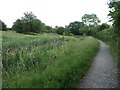
The Nottingham Canal, looking east near Newmanleys Road
In water, but not navigable.
Image: © Christine Johnstone
Taken: 21 Jun 2019
0.14 miles