
IMAGES TAKEN NEAR TO
Appleyard Grove, CRAMLINGTON, NE23 6AB
Introduction
This page details the photographs taken nearby to Appleyard Grove, NE23 6AB by members of the Geograph project.
The Geograph project started in 2005 with the aim of publishing, organising and preserving representative images for every square kilometre of Great Britain, Ireland and the Isle of Man.

There are currently over 7.5m images from over14,400 individuals and you can help contribute to the project by visiting https://www.geograph.org.uk
Image Map
Images are licensed for reuse under creativecommons.org/licenses/by-sa/2.0
Notes
- Clicking on the map will re-center to the selected point.
- The higher the marker number, the further away the image location is from the centre of the postcode.
Image Listing (15 Images Found)
Images are licensed for reuse under creativecommons.org/licenses/by-sa/2.0
Image
Details
Distance
1
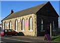
United Methodist Free Church, East Cramlington
Built in 1872 it is no longer in use as a church; but at least it has survived, unlike the pit which was on its door step.
Image: © Alan Fearon
Taken: 15 Nov 2005
0.07 miles
2
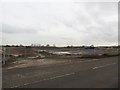
Construction site entrance, East Cramlington
One of a few entrances into a large construction site off the B1326 to the east of Cramlington. A couple of hundred houses are to be built on the greenfield site.
Image: © Graham Robson
Taken: 10 Dec 2016
0.08 miles
3
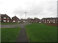
Reedswood Crescent, East Cramlington
A residential street in a housing estate on the east edge of Cramlington.
Image: © Graham Robson
Taken: 10 Dec 2016
0.09 miles
4
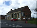
Former United Methodist Free Church, East Cramlington
Now houses light industry.
Image: © JThomas
Taken: 28 Jul 2012
0.10 miles
5
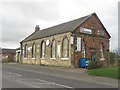
Former United Methodist Free Church, East Cramlington
The former church on the edge of East Cramlington is now occupied by a couple of local businesses, a garage occupies one end and an embroidery and work wear supplier occupies the other.
Image: © Graham Robson
Taken: 19 Aug 2018
0.10 miles
6
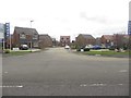
Rouen Crescent, East Cramlington
A new development of homes in East Cramlington by Miller Homes. This is the main entrance into what will be a large estate of around 200 homes when completed. Image was taken in the same location a year and half earlier and shows how much the site has changed in that time.
Image: © Graham Robson
Taken: 19 Aug 2018
0.11 miles
7
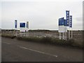
Building site, East Cramlington
Preparatory work for a large new development of houses given the name of Barley Meadow is under way on land of the B1326. The development of a couple of hundred houses on land next to the modern Northumbria Specialist Emergency Care Hospital is by Miller Homes.
Image: © Graham Robson
Taken: 10 Dec 2016
0.12 miles
8
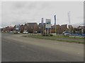
Entrance to Barley Meadows development, East Cramlington
Looking along the B1326 to the main entrance into the new development of homes on the south side of the road by Miller Homes. Image was taken 30 metres further up the road 18 months earlier and shows how much has changed in that time.
Image: © Graham Robson
Taken: 19 Aug 2018
0.12 miles
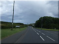
10
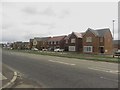
Barley Meadows, East Cramlington
A new development by Miller Homes beside the B1326 in East Cramlington. Image shows the site a year and a half earlier. Construction was continuing on a later phase of the development away from the main road.
Image: © Graham Robson
Taken: 19 Aug 2018
0.15 miles