Former United Methodist Free Church, East Cramlington
Introduction
The photograph on this page of Former United Methodist Free Church, East Cramlington by Graham Robson as part of the Geograph project.
The Geograph project started in 2005 with the aim of publishing, organising and preserving representative images for every square kilometre of Great Britain, Ireland and the Isle of Man.

There are currently over 7.5m images from over 14,400 individuals and you can help contribute to the project by visiting https://www.geograph.org.uk
Former United Methodist Free Church, East Cramlington
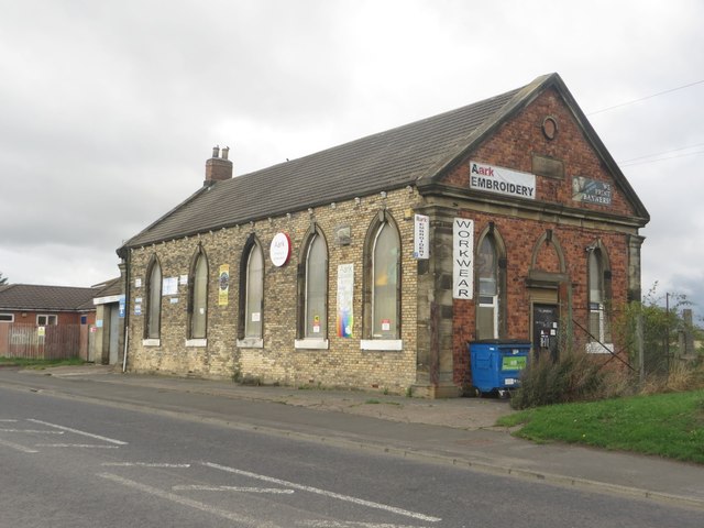
Image: © Graham Robson Taken: 19 Aug 2018
The former church on the edge of East Cramlington is now occupied by a couple of local businesses, a garage occupies one end and an embroidery and work wear supplier occupies the other.
Images are licensed for reuse under creativecommons.org/licenses/by-sa/2.0
Image Location
Latitude
55.07873
Longitude
-1.557961